Categories
Save Face Save Lives

Endangered Bat Species and LiDAR: PILLAR Technology is Mapping Conservation Efforts

PILLAR works with departments of transportation, environmental, and engineering firms to better understand the condition of infrastructure in challenging environments. LiDAR (mobile light detection and ranging) is an advanced technology that goes beyond just providing detailed maps: the data can be used to influence critical decisions to protect critical wildlife habitats.

PILLAR’s recent project at a bridge in southwestern Virginia highlights the effectiveness of LiDAR for mapping conservation efforts and managing transportation infrastructure.

LiDAR Applied to Wildlife Conservation: A Case Study

Scientists learned that the endangered gray bat and the more common big brown bat, were using this man-made structure for roosting purposes, yet engineers needed to assess the bridge’s operating conditions and schedule routine maintenance. Gray bats are listed by the Virginia Department of Wildlife Resources (DWR) and the US Fish and Wildlife (USFWS) as endangered, and upwards of 10,000 gray bats find refuge in the bridge from April through October as a maternity roosting site.

A cluster of gray bats roosting under a southwestern Virginia bridge.

The Virginia Department of Transportation along with biologists from Stantec Consulting Services, entrusted PILLAR to accurately survey the bridge with noninvasive LiDAR technology and collect data on the structure, while also preserving the bats’ habitat and wellbeing. In approximately one hour, PILLAR engineers had safely completed their survey, and biologists studied about 200 gray bats in their natural habitat.   

Experts from PILLAR teamed with biologists from Stantec to survey the bridge accurately and quickly without disrupting the roosting areas of the gray and big brown bats.

A Positive Impact

Noninvasive and accurate, PILLAR’s approach using LiDAR and its proprietary Automated Feature Extraction System (AFES) safeguards sensitive ecosystems and wildlife habitats while collecting the required data. This data then helps officials develop environmentally sensitive approaches to infrastructure maintenance planning.

Contact us at info@pillaroma.com or (276) 223-0500 to discuss PILLAR’s mobile LiDAR solutions and how next-generation asset management technology can enhance your next survey project.

Categories
Save Face Save Money Save Time

Work Smarter by Aggregating and Normalizing Your Asset Data

Technology has made creating a geospatial inventory of transportation assets far more accessible than it used to be. However, this asset data may be accumulated from many different sources and may have been collected using disparate techniques and technology, resulting in data that is formatted differently.

The inability of different systems to talk to each other often means that municipalities and departments of transportation frequently resort to recollecting data they already have because of a siloed department structure. This is costly and limiting.

But PILLAR can solve this problem. We can aggregate and normalize data from many different sources (from paper to pdf to complex databases) and departments, giving your organization far greater flexibility and eliminating the need for costly recollection of data you already have.

Getting started

PILLAR will gather all the data files you have already collected, identify what technology generated the data, then audit it and identify a storage solution for optimal visualization for the end-user. We determine goals and help create visualization tools that provide decision-makers with accessible information at their fingertips.

We will get your data into a format that will allow your organization to analyze your data and compare it to other information sources layering artificial intelligence over top of “Big Data.” The resulting enhanced database will allow you to make more informed decisions based on more complete and interconnected information.

In addition, a point cloud analysis powered by PILLAR AFES (automated feature extraction system) will let you provide asset data across your organization, integrating databases and streamlining processes to cut time and share costs.

We’ll help you create a truly useful geospatial inventory of transportation assets that can help determine your priorities, focusing on getting the best return on investment.

Contact PILLAR today so we can get started aggregating your data.

Categories
Save Face Save Lives Save Money Save Time

Mobile LiDAR Improves Safety By Reducing Need for Work Zones

Transportation surveyors are frequently exposed to significant danger from traffic as they work to collect the asset data required to maintain, build, or repair infrastructure.

The Bureau of Labor Statistics reported that transportation incidents accounted for 76% of roadway work zone fatal occupational injuries between 2011 and 2017. In 60% of these transportation events, the worker was struck by a vehicle in the work zone.

Clearly, roadway operations and maintenance require a safer, accurate, and efficient way to collect infrastructure asset data.

Reducing Traffic Exposure with Mobile LiDAR

A Mobile LiDAR scanning system is the efficient way to inventory transportation assets and their condition at highway speed, eliminating the need for a static work zone that impedes traffic flow as surveying staff conduct their work. Instead, Mobile LiDAR collects data from a vehicle driven at posted speed limits and creates a digital 3-D representation of existing road conditions within the right-of-way.

Mobile LiDAR scans the conditions of infrastructure assets like pavements, guardrails, mowing acreages, bridges, highway signs, and more. Mobile LiDAR takes transportation asset management to the next level, collecting massive amounts of data with speed, precision, and cost-efficiency. Complete surveys in a fraction of the time it takes with traditional survey methods and yield higher quality data for optimal operations and maintenance plans.

Advantages of Mobile LiDAR

  • Easily identify the location of all your transportation assets.
  • Gather robust data while mitigating exposure to dangerous working conditions for employees.
  • Avoid the extra cost and man-hours that come with work zones.
  • Reduced exposure to road accidents and other roadway related injuries.
  • Advanced collection methods ensure accurate asset data and rapid data extraction.
  • Integrate asset data with existing databases and workflows.

Minimize Employee Risk and Maximize Productivity With PILLAR

With advances in surveying technology, the transportation industry is investing in innovative asset management solutions to improve operational efficiencies, optimize budgets, and ensure employee safety in the field.  

As a transportation asset management firm, PILLAR houses advanced technological solutions like Mobile LiDAR, drone aerial collection, street level imagery, and geospatial inventory to locate your assets and identify their condition. Our robust approach to asset management merges technology with specialist expertise to optimize, develop, and execute tailored asset management plans to secure O&M funding and improve the service level of all infrastructure assets.

Partner with PILLAR today and discuss with our experts to figure out the best way to augment your staff safely, reduce traffic interference in your communities, and collect transportation asset data quicker and more accurately than ever before.  

Contact us at info@pillaroma.com or (276) 223-0500 to discuss our Mobile LiDAR solutions and more.

Categories
Save Face Save Lives Save Money Save Time

Transportation Asset Management: A Vital Tool In Community Resiliency Efforts

In recent years, local municipalities and the federal government have invested millions to make their cities more resilient and prepare for natural disasters, along with mitigating the imposing threats of climate change. Local and federal governments are realizing the critical role transportation infrastructure plays in assisting in disaster and climate adaption efforts and are searching for ways to increase community resilience, improve aging infrastructure, and decrease flood risks with transportation asset management.

Investing in Resilience and Sustainability

In 2017, the City of Miami passed a $400 million general obligation bond, with half of the investment funding community resilience, disaster, and climate relief efforts. This includes reducing flooding risks, mitigating rising sea levels, enhancing public safety, and improving infrastructure. As of March 2021, there are 7 on-going projects in the city to assess transportation assets and improve infrastructure.

In February 2021, the U.S. Department of Commerce’s Economic Development Administration awarded a $1.1 million grant to the Miami Conversancy District in Dayton, Ohio to protect communities from flooding and upgrade Dayton’s levee system. The grant is matched with a $276,254 local investment, all focused on supporting key infrastructure improvements in the Miami Valley.

Challenges of Resiliency Planning and Disaster Management

From mitigating flooded roadways to effectively planning emergency routes, community resiliency plans start with a comprehensive and accurate assessment of all transportation assets, including pavement condition, stormwater management systems, bridges, tunnels, signage, medians, and guardrails—just to name a few. 

A significant challenge for most asset management and disaster prevention systems is the lack of a reliable infrastructure asset collection, leading to delays in response time. In terms of the cost to human lives and properties, delays can be hazardous for disaster management agencies. A robust asset management and analysis system is required to ensure that the asset condition is properly assessed, so accurate insights for improving the asset are found.  

With lives at stake, effective transportation asset management requires industry expertise and next generation technology to make informed decisions based on data.

PILLAR’s Mobile LiDAR collects massive amounts of data with speed, precision, and cost-efficiency. This system helps us complete surveys in a fraction of the time compared to traditional survey methods. As a result, higher quality data is collected to develop effective emergency response and community resiliency plans and secure appropriate budgets for repair and ongoing maintenance.

With Mobile LiDAR’s fully Automatic Feature Extraction System (AFES), data can be instantly extracted and integrated with existing databases – increasing efficiency, transparency, and better planning.

BE PREPARED WITH PILLAR

Municipalities across the nation are using transportation asset management data to better prepare and protect their communities against natural disasters and the imposing threats of climate change. This is where PILLAR comes in. Equipped with the best asset management experts and advanced technology, PILLAR efficiently collects transportation asset data, accurately assess asset conditions, develops, and executes asset management plans to maintain and optimize their performance against climate change and natural disasters.

As a transportation asset management firm, we help organizations save time, money, and face (by preventing public outcry in the case of a disaster). Partner with us today and help the communities that you serve be more resilient.

Contact us at info@pillaroma.com or (276) 223-0500 to discuss your asset management plans with a PILLAR expert.

Categories
Save Face Save Time

Your Technology Guide for Geospatial Asset Collection

Geospatial technologies increasingly allow engineers and experts to evaluate assets quickly and accurately. Since the Department of Labor introduced geospatial guidelines for professionals in 2010, new methods and approaches have emerged with promising results.

Explore these technologies and their diverse applications below. Learn how advanced firms like PILLAR can help you evaluate assets, collect data, and improve infrastructure with these various geospatial tools.

Static LiDAR

Collecting assets inside buildings, through intersections, on bridges, and on the ground—Static LiDAR (Light Detection and Ranging) measures and records asset data at a precise, granular level. The efficiency and methodology of Static LiDAR provide increased clarity for more complete and valuable data.

Since the information stored details your assets accurately, Static LiDAR applies best for transportation and construction applications, improving asset insights and decision-making for operations and maintenance planning.

Mobile LiDAR

Mobile LiDAR scans roadways and other infrastructure assets with extreme accuracy and cost-efficiency. With a vehicle traversing highways, roads, and bridges, Mobile LiDAR provides detailed data on elevation, pavement conditions, guardrails, road signs and more:

  • Street and highway conditions
  • Landscape and transit elevation
  • On-the-ground data
  • Bridges, tunnels, slopes, and fences

Transportation and construction managers find great utility in this powerful mapping method, covering up to 50 miles of right-of-way every day.

Aerial Collection

Using planes and helicopters, aerial collection captures exansive plots of land by scanning and storing data without street-level detail.

Helpfully, anyone can access aerial collection data in their state since each makes this information public. While it is less detailed than LiDAR data (which most states do not publish), this format is used across industries:

  • Mining
  • Gas and Oil
  • Agriculture and Forestry
  • Infrastructure and Utilities
  • Emergency and Disaster
  • Construction Sites
  • Corridor Mapping

When you use this broad data in combination with sharp LiDAR collection methods, you’ll benefit from a global and granular assessment of your assets.

Drone Collection

Data on some assets can by difficult to collect. In some cases, data collection would block accessibility to the asset itself, present a safety issue or is simply inaccessible.. Drone collection offers a way for companies to still collect miles of asset data and related functions in the following industries:

  • Mining
  • Gas and Oil
  • Agriculture and Forestry
  • Infrastructure and Utilities
  • Emergency and Disaster

Speed through Asset Collection with PILLAR (and Save)

Committed to client safety and satisfaction, PILLAR provides quick, quality data to infrastructure professionals, by tailoring the data collection solutions and recommendations for public project improvements. Our meticulous approach promises accuracy and efficiency, and our extensive expertise means clients save time and money through our proven asset management process.

Contact PILLAR at info@pillaroma.com or (276) 223-0500 to leverage our advanced technologies and optimize your operations and maintenance plans.

Categories
Save Face

Why You Need a Geospatial Asset Inventory

Knowing the location, material, condition, and context of all your geospatial assets requires full-scale understanding. Without this global and granular view of your assets and infrastructure, it’s difficult to support decisions intended to improve assets, manage maintenance, and more.

Learn some of the most important reasons you need a geospatial asset inventory including emergency management, compliance, and development.

1. Asset locations alone are too limited in detail.

While identifying the location of an asset is essential, it’s not enough for proper evaluation and maintenance planning when material, condition, and context are left out. Geospatial technology such as Mobile LiDAR, delivers massive amounts of asset data quickly and accurately. This data is critical for optimizing asset lifecycles, pinpointing infrastructure needs, and budgeting public improvements.

2. Geospatial information integrates into existing systems.

The need to share data with many collaborators and managers has exploded as companies merge databases, share information, and combine research. Easily accessible geospatial asset data helps various departments, organizations, and stakeholders access the data they need to leverage asset insights and optimize its operations and maintenance programs.

3. Asset inventories serve many needs, functions, and organizations.

Data is a renewable resource. Once collected, your asset information can be used and extracted for new, increasingly useful applications. With the source data and extracted assets, various partners, agencies, and departments can benefit:

Moreover, to gain access, these participating organizations can share costs, furthering your budget’s reach.

4. Advanced technologies offer value and savings.

LiDAR technology and aerial collection capture large amounts of data while saving time and money on staffing crews to survey the land. Mobile and compact, these collection methods can extract asset data in mere hours and days rather than the weeks or months it might take less experienced, equipped teams on the ground.

5. Observe conditions and assets remotely.

With the data PILLAR captures for clients using Mobile LiDAR and imagery, engineers and crews can see and explore the field without stepping foot out of the office. Without the need to deploy a professional to report conditions, decision-makers can simply determine the best courses of action to save time, resources, and energy.

Automate and Streamline Asset Inventory Collection

Though some organizations and professionals struggle to coordinate such an inventory, others have found success with automated extraction methods, time-efficient technologies, and data integration abilities.

PILLAR, for example, uses automated collection and extraction processes that save time while informing maintenance and operations. Even after collecting your assets with next-generation technology (AFES, or Automatic Feature Extraction Systems), we can integrate your data within your existing GIS software.

Give your organization the complete picture of your assets and share your budgetary costs with other departments to save money and do the public good.

Contact us at info@pillaroma.com or (276) 223-0500 to discuss your assets with an expert in geospatial technology.

Categories
Save Face

Plan, Inform, and Budget with Condition Rating Criteria for Transportation Infrastructure

Effective infrastructure asset management starts with an accurate assessment of inventory conditions. Using condition rating criteria enables managers to identify the appropriate treatments and the optimal time to maintain or correct issues. The result extends the life of infrastructure assets while controlling costs.

Drainage Ditch Damaged and Full of Trash

How Condition Rating Criteria Helps Transportation Asset Management

In essence, condition rating criteria takes the guesswork out of the management of assets by helping to inform, plan, and budget for cost-sensitive improvements. So, what do these criteria look like?

What is Condition Rating Criteria

Simply put, a condition rating criteria is a scale, or series of numbers, used to describe the condition or state of a particular asset. It can be based on a numeric scale or letter grade to maintain an objective standard. The objective standard allows municipalities and transportation managers to manage and meet desired conditions or network goals.

Why Some Departments Struggle with Condition Assessments

Most municipalities and departments of transportation lack specialized staff or staff are already stretched too thin. Rather than lean on them with further needs, PILLAR has specialized and well-trained assessors who skillfully review your assets with speed and timeliness. In-house teams often take time to actually locate and assess assets. With a partner, infrastructure municipalities can save time and money, and be sure that assets are being assessed properly and uniformly.

Meeting the real conditions and needs of public safety to prevent hazards on the road takes dedication and time. Without a partner, it can take time and be hard to locate, obtain measurements, perform assessments, and identify distresses. With rating criteria used while assessing your transportation assets, you never have to worry about how you will improve transportation conditions, prevent public outcry, or justify your operating or maintenance costs.

Rate Your Assets with PILLAR

PILLAR’s assessment process helps ensure that your assets are rated as accurately and efficiently as possible. We cultivate certainty about the condition of your assets as we help you to determine how you can meet state requirements for public safety. Get your assets evaluated for their condition and needs with any kind of rating system you need PILLAR to use. Our experts are ready to discuss your goals and systems. Email us at info@pillaroma.com or call with (276) 223-0500.

Categories
Save Face Save Money Save Time

Why You Need to Invest in Pavement Preservation

Pavement Preservation is a set of cost-effective treatments that are typically applied on pavements at their early stages and are relatively in good condition. Pavement Preservation allows transportation agencies to treat more lane miles with less cost, while lengthening the pavement’s service life. Transportation agencies adopting Pavement Preservation will extend the benefit of taxpayers’ dollars, among many other benefits.

Primary Benefits of Pavement Preservation

Transportation agencies are paying more attention to Pavement Preservation as their maintenance budgets get tighter each year. This led to the wide adoption of Pavement Preservation treatments within the agency’s operations and maintenance programs. Agencies adopting Pavement Preservation treatments record major benefits that include:

  • Improves the condition of pavements and investments
  • Remains cost-effective for service life and pavement performance
  • Quick application and reduces road user costs and closure times
  • Requires fewer resources and energy than reactive maintenance
  • Stops the future deterioration of the pavement under your watch

Arguments Against Pavement Preservation Just Don’t Fly

Despite significant benefits, there are some reasons cities and towns don’t invest in pavement preservation as much as reactive maintenance tasks.

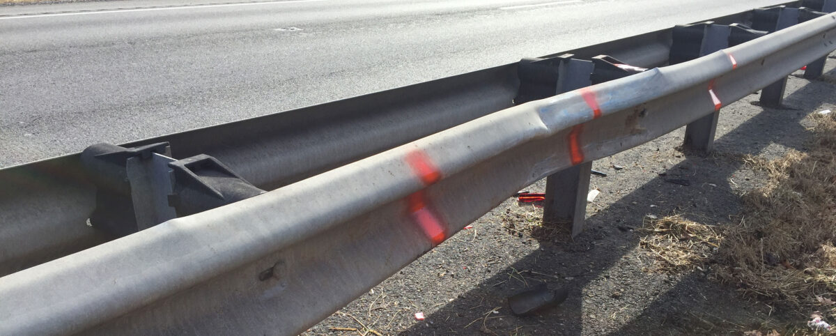
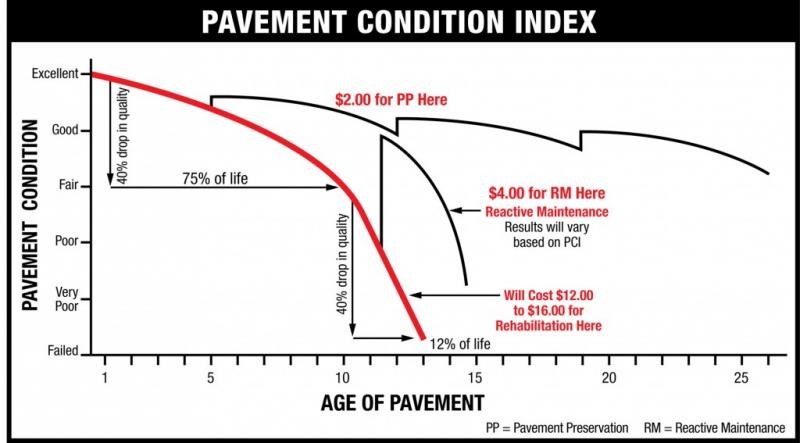
Civilians typically prefer all new pavement with new layers of either asphalt concrete or cement concrete. At the early stages of preservation treatment, pavement appears rough and messy until the treatments completely cure. To combat public outcry, engineers must continuously meet with civilians to educate them on the pavement preservation process. Engineers should demonstrate how reactive maintenance is more time-consuming and expensive, costing tax payers more money to fix damaged roads in the long run (see Figure 1).

The primary reason transportation agencies in cities and towns don’t invest in pavement preservation is due to a lack of expertise and knowledge on preservation treatments. With the variety of preservation treatments available, engineers don’t include the preservation treatments in their pavement management programs because they lack the know-how to choose the proper treatments for all road conditions.

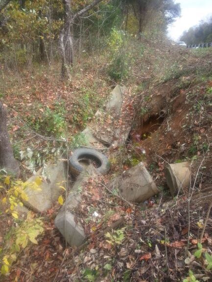
Operations and maintenance professionals default to focusing only on damaged pavements, ignoring pavements that are in good condition. Asset management budgets get eaten up by reactive maintenance when they could invest in preserving good roads, therefore investing less in reactive maintenance over time.

Some have the misconception that preservation treatments are an unnecessary expense. In reality, the treatments are quick while costs stay at a minimum. Some agencies in rural areas fear that hiring contractors with pavement preservation expertise will be more costly than local professionals, however, including pavement preservation in pavement management programs will extend budgets and the service life of pavements.

Figure 1. (Source)

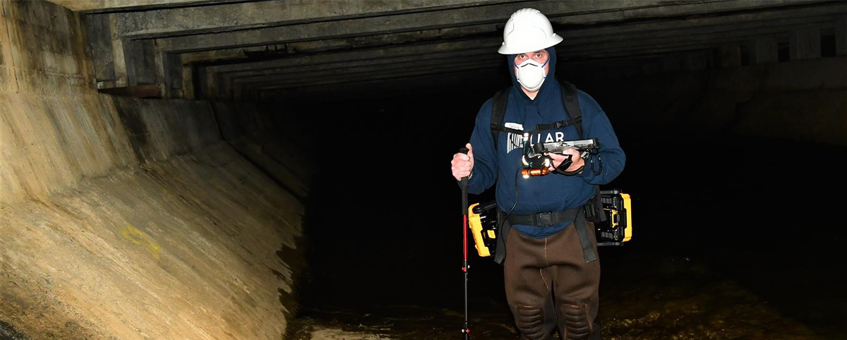
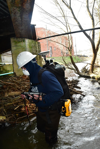
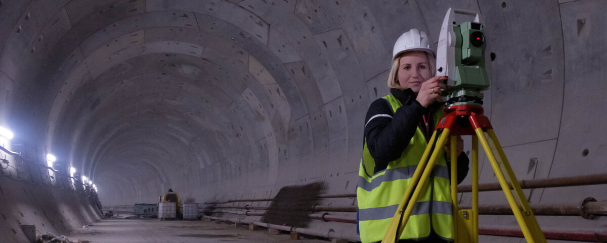
Partnering with PILLAR Pavement Management Engineers

Sometimes an organization doesn’t invest in pavement preservation due to a lack of expertise. There is a certain complexity to managing a network of roadways at different stages in their lifecycle that requires insightful data and a guiding hand.

PILLAR can play a role in assessing needs and making important maintenance decisions.

For example, PILLAR uses ratings to assess the condition of pavements, watching as the condition rating changes with time. This can be helpful to maintain a standard while getting the expertise needed for these numerous treatments.

Choosing the Right Pavement Preservation Treatments

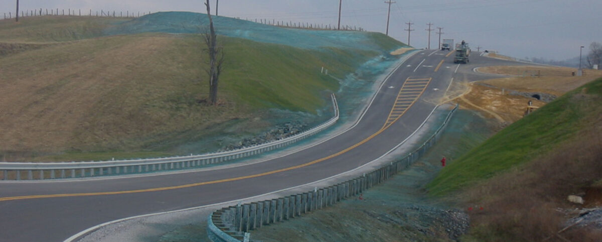
When choosing treatments, PILLAR helps you map out roads, traffic volumes, and regions to make sure that roads are treated in line with the best treatment. There is a wide variety of possible preservation treatments that make the care and maintenance of each road extremely unique.

Every preservation plan is unique based on the special features of the roadway and pavements that make planning your preservation techniques somewhat complicated without a competent partner. PILLAR works with you to identify the condition of the road or pavement and then develop a series of interventions to lengthen the lifecycle of the road, save time, and conserve budgets. Some noteworthy and famous pavement preservation treatments that can be used include:

  • Crack Sealant
  • Slurry Seal
  • Chip Seal
  • Cape Seal
  • Microsurfacing (Latex)
  • THMACO

Find a Partner in Pavement Preservation and Asset Management

PILLAR is a unique firm. It’s the only asset management team devoted at its core with maximizing the lifecycle of your assets. By delivering asset data that informs operations and maintenance decisions at every step in the complex process, PILLAR strengthens your maintenance and preservation plans in ways that could really benefit your infrastructure asset management programs.

Contact PILLAR at info@pillaroma.com or (276) 223-0500 to start with the only asset management firm that merges industry expertise, next-gen technology, and public safety to bring you unparalleled data, service, and expertise.

Categories
Save Face Save Money Save Time

Hiring Operations & Maintenance Advisors is a Sound Investment.

Assessing and leveraging data on all infrastructure assets within your right-of-way for long term sustainability can be a challenge. As a result, it becomes even more difficult to achieve long term infrastructure goals. Operations & Maintenance advisors can be a highly effective resource in managing your assets and securing the proper funding you need for improving your assets.

PILLAR is the only asset management firm whose core business is dedicated to maximizing the lifecycles of your assets by collecting and delivering asset data that informs operations and maintenance decisions at every step of the process. PILLAR’s focus is holistic and goes beyond the typical pavements and bridges that include assets such as ditches, signs, markings, fence, etc. Optimal asset management includes all assets to give a much wider and inclusive perspective to account for all variables.

Know the Location of Your Assets

Pillar’s collection process combines old school approaches with cutting-edge technology to bring you a cost-effective way to collect massive amounts of inventory data quickly and accurately. Create digital 3-D representations of the right-of-way with PILLAR’s Mobile LiDAR Scanning that includes our Automated Feature Extraction System, extracting features almost as quickly as data is collected. At the same time, you’ll work with boots-on-the-ground maintenance professionals to go places machines and technology can’t reach.

Identify the Condition of Your Assets

PILLAR doesn’t just collect asset data; our professionals assess the data collected to justify the costs required to improve asset conditions. Experts use Condition Indices to measure Condition Rating Criteria for various asset types beyond pavements and bridges, such as pavement markings, guardrails, signs, slopes, fence, and tunnels. Using computer vision allows us to use Street Level Imagery from video stills to detect asset deficiencies. Our geospatial technologies provide in-depth point cloud analysis to give you a global view of the location and condition of your assets. Experienced maintenance staff also perform on-site field assessments and visual inspections.

Take control of Your Operations & Maintenance Plans

Unlike other firms, PILLAR advisors go beyond delivering asset data and go to work on planning strategies for your assets and the future. Data integration is seamless between databases as PILLAR works with numerous suites of geospatial software. You’ll receive solutions within many different contexts, including contract development, daily, weekly, and yearly work plans, bottom-up budgeting and estimating, and response plans in the case of an emergency.

Execute Your Plans with Expertise and Certainty

The PILLAR team not only helps develop your plans, we make sure you execute them. We can augment your staff to meet your program’s needs and oversee staff to ensure your asset management plans reach an optimal result. To fully see your plans through, our advisors can hire Operations and Maintenance managers to manage and control your budget, schedule, quality, as well as your incident, disaster, and weather response. Integration is seamless, coordinated, scheduled, and proactive.

Transform Your Operations & Maintenance Plans with PILLAR

Across the board, PILLAR advisors are a valued part of your team, working to inform you about your assets, offer data-driven decisions to secure proper funding, with in-the-field experience to hire and organize the staff necessary to carry out your plans so you don’t have to.

Stop guessing what to do with your Operations and Maintenance plans and be certain with PILLAR. Email us at info@pillaroma.com or call (276) 223-0500 to get started with the only asset management focused firm merging industry expertise, next-generation technologies, and commitment to public safety.

Categories
Save Face Save Time

Transforming Geospatial Data: The Power of Geomatics

Technology is revolutionizing and transforming geospatial data. Going far beyond your typical data point collection and measurements, we can use evolving geospatial tools such as LiDAR, GPS/GNSS, and remote sensing to collect comprehensive and multi-dimensional geographic data. This data is extracted and analyzed to make data-driven decisions in the development of transportation asset management plans. 


The incorporation of these technological tools has created some confusion in the geospatial industry causing the coining of a new term, Geomatics. Geomatics has entered our lexicon to cover the multiple ways and uses of the data derived from these geospatial tools by various disciplines.

Pillar uses these advancing technologies to yield enhanced efficiency and results. Read on to learn more.

The true and sometimes subtle differences between geospatial differences create confusion. Today, those differences grow even finer as mobile mapping, asset management, and unmanned aerial vehicles become integrated in daily operations.

Defining Geospatial: More than an object

Surveying Device

Using the term geospatial indicates that an object or object set has a geographic component to it. Typically, this geographical component is identified in terms of coordinates (latitude, longitude, altitude). However, it can also relate to an addressed location such as a house number on a street in a specific city in a specific state or zip code. Most of the time the geographic component is attributed through global positioning system (GPS). However, satellite imagery or photogrammetry can be utilized to derive the geographic component.

Defining Geographic Information Systems (GIS): Controlling Ever-Growing Geospatial Data

Surveying Device Folded

Geographic information systems (GIS) manage, store, and integrate geospatial data collected from:

  • Satellite imagery
  • Demographics
  • Statistics
  • Road networks
  • Historical maps
  • Investigation, etc.

The information systems cataloging these data points helps professionals manipulate, analyze, and map their geospatial data. Through GIS, you can view, analyze, and house multiple layers of information to perform various volumetric and area calculations, create maps, and perform various types of modeling.

Since geospatial data is ever-growing, GIS becomes an essential tool for the management of valuable data for project planning and improved efficiency of research. But, when one goes beyond the collection and storing of important geospatial data, they enter the multidisciplinary science of geomatics.

Defining Geomatics: Going Beyond Geospatial Data with Interdisciplinary Science

Pillar Mobile LiDAR Screen in Vehicle

Many people describe a wide selection of geography-relevant technology and disciplines as “geospatial.” However, “geomatics” involves more specifically the sciences of:

  • Surveying
  • LiDAR
  • Cartography
  • Satellite navigation
  • Photogrammetry
  • Mapping, etc.

While these are all excellent geospatial methods with formal procedures, geomatics also includes other sciences seemingly divorced from geo-inquiry such as:

  • Computer science
  • Mathematics
  • Engineering

To put it more simply, geomatics synthesizes spatial information with scientific application. It concerns the measurement of the Earth and technologies that help you act on that information. Geomatics goes beyond mere data to solve complex infrastructure problems with the latest technology.

Pillar is a dedicated transportation asset management firm focused on collecting, analyzing, and turning data into decisions for transportation infrastructure.

Our proprietary CAPE approach for asset management integrates geospatial data with geomatics to optimize and execute operations and maintenance plans for infrastructure organizations.

Asset Management Experts

PILLAR is the only asset management firm whose core business is dedicated to maximizing the lifecycles of your assets – delivering asset data that informs operations and maintenance decisions at every step of the process. We use your existing data to extend the life of your assets for roadways, bridges and tunnels. We assess data availability and accuracy to give you an operations and maintenance plan developed to optimize budgets and timelines.

At PILLAR, we’re ethically and completely committed to the safety and satisfaction of the public. We give unbiased and evidence-based recommendations and solutions for the improvement and maintenance of roadways.

Contact us at info@pillaroma.com or (276) 223-0500 to get started with the only asset management focused firm merging industry expertise, next-generation technologies, and commitment to public safety.