Categories
PILLAR Talk Save Face Save Lives Save Money Save Time

Benefits of Proactive Culvert Cleaning

As summer heats up, so do thunderstorms. This can mean sudden inundation of heavy rain, increasing the risk of dangerous flooding for your assets. Flooding is a serious issue that is exacerbated by blocked culverts which can cause road collapse resulting in trapped residents at best and loss of life at worst. To stay ahead of the game, a proactive culvert condition assessment and cleaning plan helps prevent dangerous roadway flooding.

Reactive Culvert Cleaning Has a High Price Tag

Culverts can be difficult to access, making it easy to put off regularly assessing their condition. Unfortunately, with this approach asset managers only become aware of blocked culverts when a storm rolls in. By then it’s too late to prevent dangerous flooding or road collapse.

Addressing emergencies is paramount but that doesn’t mean that it isn’t challenging. Multiple high-stakes events can quickly exhaust staff, equipment, and budgets. Tasks get backlogged and expenses can mount including:

  • Labor costs in the form of wages and benefits for the crew members who work on the emergency mobilization.
  • Equipment costs such as renting or deploying any necessary equipment like excavators, dump trucks, or bulldozers.
  • Transportation costs include transporting the crew and equipment to the job site.
  • Overtime pay can be a factor if the emergency mobilization requires work outside of normal business hours.
  • Permits and fees might be required to carry out the emergency mobilization.
  • Material costs can include any materials needed for the job such as sand, gravel, or concrete.

Proactive Culvert Cleaning Saves Time, Money, and Lives

For years, PILLAR has helped municipalities and DOTs manage assets.  In addition to our planning and execution expertise, we have tools that makes it easy to collect geospatial data in underground assets. We deploy the DeepTrekker 240 L Pipe Crawler robot to safely and efficiently identify culvert conditions and possible flaws. It’s portable, submersible, and can access areas that are difficult or unsafe for humans to enter.  Its rugged design and camera with full functionality give you complete control of your data collection and assessment.

When you combine this tool with a management plan created specifically for culverts in your service area, you’ll have a proactive plan that allows you to schedule crews to maintain culverts regular hours in good weather. You’ll likely experience less flooding and safer roadways too.

This planned approach saves you time and money because you’ll have less backlogged tasks and unplanned expense related to crisis management. And your team will love the culture of sustainability that develops as a result.

Contact PILLAR

Creating a proactive plan for your transportation assets doesn’t have to be overwhelming. With our decades of combined experience, PILLAR can help you stay in front of potential emergencies like clogged culverts. Book a discovery meeting with PILLAR to learn more about how we can help you develop a systematic solution for your transportation infrastructure.

Categories
PILLAR Talk Save Money Save Time

How Knowing Your Mowing Acreage Helps You Avoid Cost Increases

If you use mowing contractors, you may be familiar with the incremental “bump” in acres/prices that happens as they spend more time, labor, and resources to fulfill their mowing duties. That’s because often contractors accidentally begin mowing more and more areas. This scope creep is unintentional; sometimes, it’s just a normal byproduct of the job and it happens more frequently when there’s a lack of clear acreage guidelines. 

To help contractors stay on track it’s important to regularly assess your mowing acreage. It may seem like a small detail but being clear about how much acreage you’re responsible to mow can save you millions.  

How PILLAR Calculates & Classifies Mowable Area 

PILLAR specializes in providing rapid and accurate data collection and assessment so you always have the most up-to-date information about your transportation assets.  

When you work with us, you’ll benefit from Mobile LiDAR (Light Detection and Ranging), a powerful mapping method. Mobile LiDAR uses laser scanning to accurately identify roadway assets and related infrastructure at highway speeds. Typically, LiDAR captures data for hundreds of miles of right-of-way a day, making it the ideal solution for use in asset management, geospatial (GIS), and surveying and mapping. Plus, our mobile LiDAR service includes a fully automatic feature extraction system that saves up to 10-fold the time and cost of traditional “point and click” semi-automatic extraction methods.  

With PILLAR, it’s easy to regularly assess your mowing acreage so you can keep your organization on track. 

PILLAR Goes the Extra Mile So You Don’t Have To 

We don’t stop at data collection and extraction. Our services also include an assessment of the terrain you’re responsible to maintain so you can know with certainty:  

  1. the types of equipment you need.  
  1. the time and frequency required to maintain your acreage.  

The information we gather helps us configure the most efficient mowing patterns for full mows or partial mows. We also leverage our knowledge of stormwater regulations to determine if you can earn environmental stipends for mowing less frequently. 

After all the data is collected, we will work with your geospatial system of choice to integrate and normalize your mowing data. The resulting enhanced database keeps your mowing contractors informed with complete and interconnected information. 

Contact PILLAR 

The PILLAR team has more than 100 years of combined experience working with and for municipalities and departments of transportation. Our clients trust our cutting-edge methods and results. Learn how we can help you avoid mowing scope creep to save time and money. Contact us today. 

Categories
PILLAR Talk Save Money Save Time

How Proactive Ditch Cleaning Mitigates Emergency Mobilization

As an asset manager, you know how hard it can be to stay in front of potential emergencies. Asset management is a complex, ever-changing landscape and part of the job involves responding to unforeseen events.

However, many asset managers report that 80% of their job is dealing with crisis and only 20% is devoted to planning. With the right support, it’s possible to flip that ratio so you spend less time and money reacting to crisis. Taking a proactive approach to your asset management makes a huge impact on team morale, stress levels, and your bottom line.

How Reactive Ditch Cleaning Hurts Business Outcomes

Most people overlook the important role ditches play in keeping roads safe and usable. Until, that is, a storm rolls in and the ditch is clogged or blocked. Roads (and even homes) can become rapidly flooded, making them impassible and creating an emergency.

Emergencies like this can happen at any time of day or night regardless of whether you have enough staff, equipment, and time available. Gathering your resources and reacting in a timely fashion can be exhausting and expensive. When you’re stuck reacting to emergencies, costs can easily skyrocket. Expenses can include:

  • Labor costs in the form of wages and benefits for the crew members who work on the emergency mobilization.
  • Equipment costs such as renting or deploying any necessary equipment like excavators, dump trucks, or bulldozers.
  • Transportation costs include transporting the crew and equipment to the job site.
  • Overtime pay can be a factor if the emergency mobilization requires work outside of normal business hours.
  • Permits and fees might be required to carry out the emergency mobilization.
  • Material costs can include any materials needed for the job such as sand, gravel, or concrete.

How Proactive Ditch Cleaning Improves Business Outcomes

Contrast this with a thorough assessment and management plan created specifically for the ditches in your service area. Instead of mobilizing crew and equipment after a clogged ditch becomes a problem, generate a list of clogged or at risk ditches during regular inspection. Then, schedule crews to clean them in order of severity during regular hours during good weather.

This proactive, planned approach will save you time and money. You’ll find that you backlog less tasks, avoid unplanned expenses related to crisis management, and create a culture of stability for your team.

Utilize Pillar’s CAPE Method for Maximum Results

Pillar specializes in data collection, assessment, planning and execution through our proven CAPE method. With Pillar on your side, you can have powerful data to create a systematic planning and management program, be intentional about your asset management, and take control.

Stay in front of potential emergencies with solid planning and execution. Book a discovery meeting with PILLAR to learn more about how we can help you develop a systematic solution for your transportation infrastructure.

Categories
PILLAR Talk Save Face Save Lives

The Road to Zero Fatalities in 2023

National Transportation Safety Board Chair Jennifer Homendy cast a vision of zero fatalities as the standard metric by which transportation safety is measured during her keynote speech at this year’s Transportation Research Board (TRB) Annual Meeting 

“Plenty of people think that zero deaths is an unrealistic goal,” Ms. Homendy noted. But she pointed out that any transportation fatality is a tragedy. “We must care about the safety of strangers…because it’s the right thing to do.”  

Steps Toward Zero Fatalities  

Ms. Homendy’s stirring speech inspired transportation industry professionals to consider the ways in which they could work toward the goal of zero fatalities within their area of responsibility. While advances in technology and equipment have created great leaps in highway safety, it’s often the routine maintenance tasks that make the difference. These tasks can include: 

  • Ensuring assets are in a state of good repair. 
  • Installing guardrails properly and inspecting them regularly. 
  • Installing wrong way detection devices. 
  • Maintaining markings for all lanes (vehicle and bike/pedestrian) keeping them bright and vibrant. 
  • Replacing faded or illegible signs and ensuring they are retroreflective. 
  • Repairing damaged pavement and staying ahead of potholes. 
  • Keeping drains open to prevent back up and reduce the possibility of flooding.  

The tasks are straightforward, but they are rarely simple. Transportation asset management is a complex job with an ever-changing set of demands. Creating and executing a regular maintenance schedule is more difficult than it sounds. And that’s where Pillar can help. 

How Pillar Can Help You Keep Roads Safe 

PILLAR is an asset management firm comprised of multidisciplined professionals with decades of tactical, strategic, and operational experts who are ethically committed to the well-being and safety of the public.  

We deploy our proven CAPE method for every client to help them avoid pitfalls and overextended budgets. Through collection, assessment, planning, and execution, they have powerful data to create a systematic planning and management program, be intentional about their asset management, and reduce fatalities on the road. Here’s how it works: 

Collection: PILLAR’s collection process combines cutting-edge technology with time-proven approaches. We will collect all existing and new data and normalize it with the tools you’re already using. 

Assessment: Using a combination of modern technology and hands-on field experience, we can accurately evaluate the condition of your assets. 

Planning: We can help with asset management planning. Our data-driven strategies clearly address your assets’ maintenance needs to help you secure necessary funding and close the skill gap for your company. 

Execution: PILLAR’s execution process uses the best-equipped Operations and Maintenance managers to help reduce skill gaps, address public concerns, handle financial adversity, manage and monitor contractors, inspect jobs, and adjust existing plans. 

Contact Us 

Ms. Homendy emphasized, “Safety, especially when it comes to new policies new transportation policies and new technologies whether it’s on our roads in the air or anywhere throughout our transportation system, cannot be overlooked ever.”  

We couldn’t agree more. Contact us today to see how we can help you work toward the goal of zero fatalities in your transportation infrastructure. 

Categories
PILLAR Talk Save Money Save Time

Are You Getting What You Ask for in Your LiDAR RFP?

If it’s too good to be true, it probably is.

Beware of any proposal that doesn’t spell out target accuracy requirement details and is coupled with a lower price. You may be left with inaccurate data that will cost you much more down the road, opening you up to costly change orders. A responsive and responsible bidder will always clearly spell out how they plan to meet target accuracy requirements so you can make an informed decision.

Many bidders will try to confuse proposal reviewers and prey on their lack of technical training. They take advantage of reviewers who aren’t familiar with the difference between RTK/PPK correction or absolute accuracy and relative accuracy. By using a lot of buzzwords and citing equipment accuracy tolerances, they hope to convince you that a surveyor, validation/check, and control points aren’t necessary to prove accuracy. You may read the proposal and believe that utilizing a scanning vehicle equipped with an IMU, GNSS, wheel encoders and a DMI to prevent drift and self-correct will be within accuracy requirements.

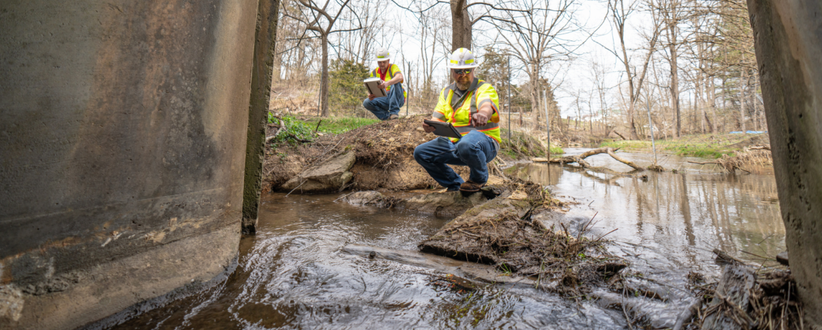
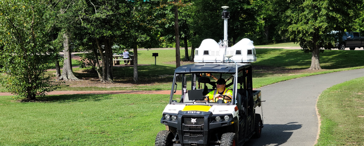
Sometimes you want the data accurate down to the inch and sometimes positioning within a few feet is acceptable enough for crews to locate an object in the field. Today’s mobile LiDAR equipment is powerful and allows us to do amazing things when it comes to location and accuracy. However, any specified accuracy still needs to be checked or verified.

How to Think About Point Cloud Accuracy

Imagine you walk into a dark warehouse (Point A) and need to get to a door on the other side (Point B). If the lights were on, this would be a simple task. You can see where you’re going and walk toward the door. With the lights out, the task becomes more complicated. You’ll likely unintentionally drift off course between Point A and Point B. When you get to the other side, you’d be unable to report how straight your path was let alone if you are even at the door, until you turn on the lights and adjust your position to the door.

Now imagine you’re in the same dark warehouse, but now you have familiar objects like a table, chair, or desk you can tap as you pass by. You’re much likelier to find the door by checking your position as you go. This method allows you to correct your course along the way and ensures that you actually are where you think you are.

Now imagine you’re in the dark warehouse with a dusty floor and your familiar objects, but also notches in the floor every so often marking the path. You get to the other end, turn on the lights and can see the path you took. The notches on the floor allow you to measure the distance between your footprints and your target path to check your accuracy and validate how close you were to following the path. Without those notches in the floor, you can’t validate your accuracy because you have nothing to measure against to verify or validate specified tolerances.

This is why it is necessary to tie mobile LiDAR scans to surveyed control points when a target accuracy is specified. Control points make it possible to correct positioning and adjust the recorded course to match the real-world course, just as tapping a known object as you walk through the darkened warehouse allows you to adjust your trajectory to the door. Furthermore, validation points allow you to verify that your data falls within the specified accuracy threshold. Without validation, asserting that the data is accurate would be impossible.

Applying surveyed control and validation points to your mobile LiDAR data is like walking across the darkened warehouse, with your path lit by tiny lights that guide your way. You may not be able to see your entire environment, but you have enough reliable information to arrive at your goal.

Poor GNSS Signal and Accuracy Challenges

Absolute Accuracy vs. Relative Accuracy are must-know terms for anyone evaluating an RFP.

  • Absolute accuracy refers to whether or not objects in the point cloud fall near their actual location in the real world. This is sometimes referred to as “accuracy.”
  • Relative accuracy refers to whether or not objects within the same point cloud lie in true positions relative to one another and if the object occupies the same location in multiple passes. This is sometimes referred to as “precision.”

Ideally, data should be both accurate and precise. To achieve this, professionals often use RTK (real-time kinematic) and PPK (post-processed kinematic) technologies to correct raw GPS data and achieve centimeter-level positional accuracy. However, this technology is contingent on a strong signal at the site from one or more GNSS constellations, as this raw satellite data forms the basis of your data corrections.

Professionals commonly utilize data from base station networks like CORS (Continuously Operating Reference Stations), operated by NOAA, or from subscription base station networks to perform RTK/PPK corrections. These networks are comprised of base stations situated atop points of known position and/or elevation. These base stations monitor GNSS signals from various constellations to:

  1. determine how inaccurate the GNSS calculated position is and
  2. determine an appropriate correction.

This correction can then be applied to your mobile LiDAR trajectory within a reasonable distance of the base station. Thus, an RTK/PPK corrected position will be more accurate than the raw GNSS calculated position. However, these corrections only apply to data received from the GNSS satellite constellations. They offer no benefit in situations where the GNSS signal is significantly blocked, as is the case in heavy canopy, urban canyons, or any area with a significant portion of the sky obscured.

It should be noted that, with respect to mobile LiDAR scans, these corrections alone are not sufficient to claim any particular accuracy. Additional steps are therefore necessary in order to validate and report the accuracy of the resulting point cloud.

Trajectory, Control, and Validation of Your Point Cloud Data

The three warehouse examples emphasize the three phases of point cloud data location and accuracy that are easy to confuse.

  1. PPK/RTK corrections from base station data (i.e. CORS). This phase helps correct errors in the position based on the GNSS signal and are provided by base stations operated from known locations. These stations don’t actually have to be within the survey area, just within a reasonable distance (usually a couple dozen kilometers, though this is dependent on terrain and other field conditions). This correlates to the first warehouse example where you need to correct errors in your overall path as a whole (trajectory).
  2. Control Points. These are surveyed points within the data collection area that are visible in the data and can thus be used to anchor the data to a known datum. In other words, they are used to adjust the data to its correct real-world position. Control points will help correct errors arising from the local environment or the mobile LiDAR scanning unit itself. This correlates to the second warehouse example where you are touching objects as you move through the warehouse. It’s useful in cases where you need to correct errors from the ground within the bigger picture and tie it to the ground.
  3. Check Points. These are surveyed points within the data collection area that are visible in the data, but they are not used to adjust the data, only to measure the offset of the location of the data to its real-world position. Check points are for reporting accuracy and verifying the data. This correlates to the third warehouse example where you have notches in the floor (i.e., a known real-world position) and are comparing them against the footprints on the dusty floor tracking your location (point cloud position). This validates that all remaining errors are within acceptable limits.

How does this all work and interrelate? #1 is frequently used on its own if there is no accuracy requirement. If there is an accuracy requirement, the only way to prove that the requirement has been met is with #3. However, there’s a good chance that in areas of poor GNSS reception (heavy tree canopy or blocking mountain faces), #1 will not be sufficient to meet accuracy requirements, so #2 would need to be used in those areas as well. It wouldn’t ever make sense to use #2 without #3, because #2 takes a lot of effort and you would certainly want to prove that #2 has worked. An important note, no single point should ever be used as both #2 and #3.

Work with a Responsive and Responsible Bidder

Some bidders may assert that you don’t need to set control points or validation points and can save lots of money. The problem is that by doing this, they aren’t responding to your accuracy requirements and therefore are not a responsive and responsible bidder. No accuracy can be demonstrated without a comparison to known, real-world positions (validation points).

A solid proposal will tell you the number of validation points it will take to verify that your data meets accuracy and how and where these points—and any necessary control points—will be established.

PILLAR prides itself on our commitment to quality and accuracy. We utilize cutting-edge technology, including mobile LiDAR, alongside over a century’s worth of combined expertise to be a partner you can rely on. Contact PILLAR today to learn more about how we can assist you with your next project.

Categories
PILLAR Talk Save Face Save Lives

Are Your Guardrails Potentially Deadly? Here’s How to Fix It

Guardrails are meant to keep drivers safe on the highways, but improper installation practices make guardrails yet another life-threatening hazard for motorists. 

What are Frankensteined Guardrails?

In the spring of 2020, high school senior Isabella Alonzo was killed after crashing into a guardrail on a Georgia highway. Instead of cushioning the impact, the ‘Frankensteined’ guardrail impaled her car. Like the famous monster, the guardrail was assembled from parts made by different manufacturers.

Frankensteined guardrails occur when a guardrail and a terminal are mixed-and-matched. This practice is against federal guidelines because guardrails are engineered to collapse on impact. When guardrails are piecemealed together from disparate parts, the guardrail may not collapse and instead pierce a vehicle moving at highway speeds.

How to Correct Frankensteined Guardrails

The first step in correcting Frankensteined guardrails is to conduct an inspection of all the guardrails in your asset inventory. These guardrails may be difficult to spot for the untrained eye, but experts have no trouble identifying the potential dangers. For example, PILLAR’s guardrail experts are familiar with installation practices of various types of guardrail systems and can quickly and easily identify Frankensteined or damaged guardrails.

You may consider engaging an infrastructure asset management firm with technological capabilities to conduct a thorough inspection of all your guardrails. At PILLAR, we’re equipped to handle the most complex data collection. Not only can PILLAR perform a manual survey, but we can also leverage data collection from the air through our mobile LiDAR, spherical images, and point cloud technology. This comprehensive method is quick, efficient and prevents dangerous guardrails from being overlooked.

It is imperative to correct any Frankensteined guardrails as soon as possible to prevent unnecessary loss of life. If your current roadside crew is stretched thin, PILLAR provides boots-on-the-ground support to rapidly address safety issues, keep you in compliance with federal guidelines, and reduce the danger to motorists.

Contact PILLAR

Frankensteined guardrails pose a deadly threat to the public, but PILLAR can help. We are a firm of multidisciplined professionals with decades of tactical, strategic, and operational experts who are ethically committed to the well-being and safety of the public. From data collection to staff augmentation PILLAR can help optimize your asset management. Our team of experts is eager to speak with you; contact us today!

Categories
PILLAR Talk Save Face Save Lives Save Money

PILLAR Helps VDOT Dramatically Reduce Nutrient Credit Cost

As you traveled Virginia’s roadways this summer, did you notice taller grass and wildflowers in the right-of-ways? It’s not an oversight.

As part of its overall commitment to implementing sustainable approaches to managing Virginia’s roadway system, VDOT implemented a right-of-way maintenance program that significantly reduced mowing and converted eligible right-of-way spaces into beneficial land uses such as meadowland or pollinator habitats. The root systems of plants and grasses allowed to grow in the right-of-way capture nitrogen, phosphorous, and other harmful nutrients and prevent them from polluting waterways in the Chesapeake Bay Watershed. Additionally, this practice reduces emissions and fuel use from mowing equipment and provides much-needed habitat for bees, butterflies, and other pollinators crucial to our ecosystem. 

Why is this so important?

The Chesapeake Bay Watershed was once primarily comprised of forest and wetlands that absorbed and filtered harmful nutrients and balanced the ecosystem. Today, 18 million people call the Chesapeake Bay watershed home, along with industry, businesses, and farms. The watershed is crisscrossed with roads that are an essential part of daily living but carry a serious environmental impact as stormwater runs off pavement and into waterways that feed into the Chesapeake Bay. High levels of nitrogen and phosphorous fuel algae growth, blocking sunlight from underwater grasses and reducing the amount of available oxygen to marine life.

VDOT Stormwater Management Tools

VDOT operates under a Municipal Separate Storm Sewer System (MS4) permit issued by the Virginia Department of Environmental Quality (DEQ) which provides regulations to protect and improve water quality in the Chesapeake Bay by requiring the implementation of stormwater controls, including effective land use management practices such as right of way conversion.

To cover the cost of offsetting impacts that cannot be fully mitigated, VDOT is required to purchase what is called nutrient credits from the Virginia Department of Environmental Quality.

PILLAR Helps VDOT Quantify the Positive Impact of Right of Way Conversion

VDOT’s stormwater management consultant, Stantec, informed VDOT that the right-of-way dedicated to sustainable practices qualified for a reduction in the amount of stormwater controls or nutrient credits VDOT would need to implement or purchase. However, to achieve a reduction, VDOT had to quantify the total area of right-of-way included in the sustainability program.

PILLAR provided the solution by using mobile LiDAR to scan and collect data on more than 775 miles of roadway and right of way in the VDOT Districts draining to the Chesapeake Bay watershed. Using PILLAR’s proprietary real-time Fully Automatic Feature Extraction System (AFES) to extract the data, PILLAR quantified the amount of right-of-way under VDOT’s right-of-way sustainability program.

The result?

The amount of right-of-way in VDOT’s sustainable maintenance program was so significant that it dramatically reduced the cost of implementing stormwater controls and nutrient credit purchases, saving VDOT and the citizens of Virginia millions of dollars.

PILLAR is proud to have been recognized for our efforts to support environmental stewardship and how their maintenance plans positively impact the environment. Contact us to learn more about how our technology can help support environmental preservation efforts.

Categories
PILLAR Talk Save Money Save Time

DOT Strategies to Alleviate the National Snowplow Driver Shortage

For the third straight year in a row, DOTs are facing a shortage of snowplow drivers. A survey by the American Association of State Highway and Transportation Officials shows that 84% of respondents reported higher to much higher snowplow operator vacancies than normal. 

Snowplows are a critical component of keeping the roadways clear during winter storms. Without the proper number of qualified drivers, municipalities will face difficult decisions. They may call upon their management staff to fill the gaps to provide citizens with services they rely on.

Short-Term Strategies to Do More with Less

When DOTs are forced to put managers and supervisors with CDL driver credentials in snowplows, their regular responsibilities such as planning and other tasks become rapidly backlogged and important tasks get dropped. In other words, this short-term solution creates long-term problems. Pillar can help keep the department on track and moving forward through its staff augmentation services. Pillar works with you to optimize snow management plans and implement efficiencies to take control of snow event response even if you have fewer trucks on the road by rearranging snow routes and developing efficient response plans that work with the resources you have. This same approach can also be used for other tasks requiring CDL drivers.

Long-Term Strategies to Address the CDL Driver Shortage

Navigating from snow event to snow event in crisis mode due to a lack of CDL drivers is stressful and inefficient. And, let’s face it, that stress extends throughout the year with any task that requires CDL drivers. There’s a longer-term strategy to deal with the CDL driver shortage that puts you in control. Our staff helps fill management and planning shortages on demand and can get to work immediately to sustain productivity until the crisis has passed. Through Pillar’s staff augmentation services DOTs have access to experienced maintenance professionals that can provide:

  • Crew and contractor monitoring and inspecting
  • Supplement work and equipment forces
  • Specialized expertise
  • Quick execution of backlogged tasks

Take Control Today. Contact PILLAR.

Pillar stands ready at a moment’s notice to support your team through the remainder of this season’s winter event. With spring in sight, now is the time to start planning for next year’s winter season.  Let us help you take charge of your snow program despite driver shortages by optimizing your plan and creating efficiencies.  Contact us today.

Categories
PILLAR Talk Save Money Save Time

Is Smartphone LiDAR Right for Transportation Asset Collection?

Apple fully embraced LiDAR technology when they released the iPhone 12 Pro that came equipped with a LiDAR scanner, giving users the ability to engage with augmented and virtual reality technologies more easily.  

With LiDAR now available to any smartphone user, you may wonder if iPhones can be used for transportation asset collection. In short, the answer is no. Read on to find out why.

What is LiDAR technology?

LiDAR stands for light detection and ranging. It works by pinging lasers off objects and calculating how long it took for the light of the laser to reflect from the object. The collected data is then used to create 3D maps. LiDAR was first used in the 1960s when laser scanners were mounted to airplanes and gained popularity in the 1980s for use in GPS technology. [1]

In the world of smartphones, LiDAR enabled devices allow users to create 3D renderings of their environment at distances up to 5 meters. Typical applications for this technology include more accurate photos, improved motion capture, and—most importantly—augmented and virtual reality experiences at home or day-to-day environments.

LiDAR and Transportation Asset Management

The Transportation Asset Management industry regularly uses LiDAR technology to maintain the integrity of transportation assets. It’s a critical tool for keeping an up-to-date understanding of the condition of roads, bridges, tunnels, rails, and more. But the process of collecting and using that data extends far beyond a single smartphone camera designed to collect data at walking speed. Although there may be some specialty use that can come from smartphones, this is limited due to the lack of large-scale data that is able to be collected.

At PILLAR, our imagery scanning technology powers data collection at highway speeds to give you an impressive and detailed understanding at the street level. Our technology includes:

  • 360-degree spherical
  • 6 – 5MP cameras – 30MP
  • Drone aerial collection
  • Faster data collection: laser collection at posted speed limits enables the ability to scale.
  • Street-level imagery: snapshots of roadways during data collection.
  • Global view of infrastructure assets

Not only that, but we are the only company to offer a true, fully automated feature extraction solution by pairing our mobile LiDAR with AFESTM to process the data we collect.  Without AFESTM you could spend hours formatting your data, scrolling through overlapping photos, and linking assets. When you work with PILLAR, you can have reliable, immediately usable data so you can act and plan for the future.

Invest in Professional LiDAR

The stakes are high when it comes to having accurate data because deteriorating assets can lead to injury and death. When accuracy is paramount, using LiDAR-enabled smartphones to capture asset data isn’t a realistic way to get the job done. These cameras can only capture environments up to 5 meters away and at walking speed. The user must manually collect a 360 view. Contrast that with PILLAR’s six 360-degree cameras that can collect images at highway speeds.

In addition, asset management requires more than just data collection, you need data you can use. Between processing time, feature extraction, and access to reliable data, it’s much more cost effective to invest in a LiDAR professional.

Contact Us

At PILLAR, our multidisciplined professionals have decades of experience to keep your assets in a state of good repair. From boots on the ground to points in the cloud, PILLAR has you covered. Contact us to discuss your needs and questions.

[1] https://www.britannica.com/technology/lidar

Categories
PILLAR Talk Save Face Save Money Save Time

PILLAR to Begin Work on The Virginia Capital Trail

A new partnership between PILLAR and VDOT will utilize cutting-edge technology to make Virginia a safer, more beautiful place for cyclists and pedestrians.

Recently, PILLAR received a task order to inventory assets, assess, and maintain the Virginia Capital Trail. The Virginia Capital Trail was originally a scenic road that connected Virginia’s capital to the coast. Then called Route 5, the drive was widely valued for its natural beauty and character. In 2004, The Virginia Capital Trail Foundation was formed to advocate and fundraise for a recreational trail adjacent to Route 5. In 2008, construction on the project began. Today, The Virginia Capital trail is a 51.7 mile, fully paved trail that stretches from Williamsburg to Richmond and is enjoyed by cyclists, runners, walkers, skateboarders, and more.

Maintenance of the nearly 52-mile trail is no small task. To keep the Trail well-tended, The Virginia Capital Trail Foundation secured a public-private partnership with the Virginia Department of Transportation. VDOT is responsible for maintenance of the Trail from making repairs, clearing debris, or cutting the grass. VDOT faced the challenge of proactively monitoring each mile of the Trail to ensure repairs happened quickly and citizens stayed safe. To address the challenge, VDOT partnered with PILLAR to leverage their expertise and engage them to scan the trail with mobile LiDAR.

For maximum efficiency and safety in transportation maintenance, data is key. As part of the Trail inventory process, PILLAR’s modern technology will automatically extract key features important to the upkeep of the Trail utilizing proprietary AFESTM Technology. This data provides a comprehensive baseline overview of the Trail. From this starting point, PILLAR will make validated maintenance plans enabling VDOT to address issues so pedestrians and cyclists can continue to enjoy the trail now and into the future. “We are honored to partner with VDOT in the maintenance of this beautiful and historic trail and play a part in helping Virginians to enjoy the natural beauty of our state,” says PILLAR Vice President Eric Brooks. 

PILLAR is an award-winning organization that has been recognized for their stewardship and the ways in which their maintenance plans have positive impacts on the environment. As the partnership continues, PILLAR and VDOT anticipate that scheduling short- and long-term personnel to address the hands-on work of maintenance will become more efficient. Other areas of impact include brush management, pavement management, signage and more.