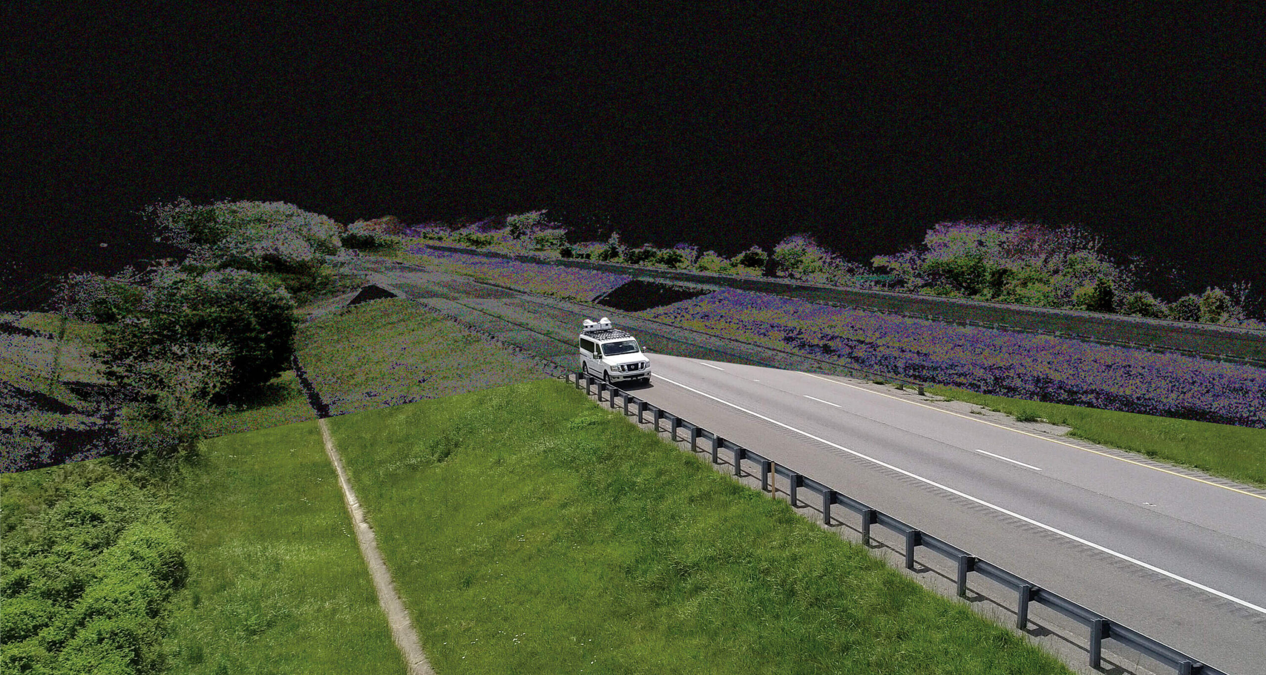
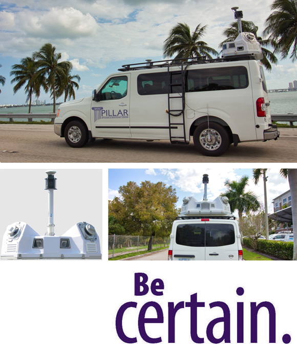
Mobile LiDAR Scanning
Pillar’s collection process combines cutting-edge technology with old school approaches to instantly locate assets. Mobile LiDAR collects massive amounts of data with speed, precision, and cost-efficiency. Surveys are completed in a fraction of the time it takes with traditional survey methods and yield higher quality data upon which to better plan and budget. These efficiencies offset the investment in specialists to do the work.
The fastest way to collect massive data
Collected at posted speed limits, we use LiDAR to create digital 3-D representations of existing road conditions within the right-of-way.
PILLAR’s mobile LiDAR service includes a Fully Automated Feature Extraction System (AFES) that extracts data and integrates with your existing databases.

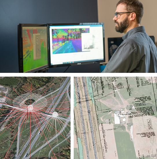
Make Inventory Collection Work
PILLAR is proficient in collecting your inventory using various methods: mobile LiDAR, plan sheet georeferencing, imagery scanning, GIS mapping, and traditional surveying. Unique to PILLAR, our fully automatic feature extraction process accurately identifies, categorizes, and quantifies various asset types from a LiDAR point cloud.
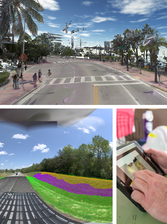
Automated Feature Extraction
Rather than traditional “point and click” semi-automatic extraction, LiDAR with AFES means fewer days to completion of your global view. AFES reduces cost and time up to tenfold* by using multiple algorithms simultaneously to classify various assets and obtain their attributes. Gone are the days of spending countless man-hours scrolling through pictures overlapped on the point cloud, pointing a cursor and clicking on the asset to spatially link the two.
Instantly extract features as data is collected
Machine Learning, AI, and Computer Vision are incorporated in the processing of this data. It outputs to standard GIS formats, Shape files, geodatabases, and more. You can also convert to system-specific formats through data integration and conversion.
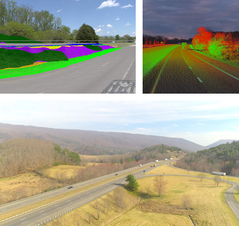
More than 20 asset types can be automatically extracted from the LiDAR data, including:
- Signs
- Bridge Clearances
- Ditches
- Guardrails
- Mowing Acreage
- Overhead Utilities
- Trees
- Striping
We can export data visualizations using a colorized point cloud, JPG, video files, and more. If you don’t see an asset above, contact us to learn more about our full capabilities.
*Timelines vary from project to project and may exceed one or two days.
Imagery Scanning
Our imagery scanning and data collection technology powers an impressive and detailed understanding of the street level at highway speeds. The technology is 360-degree Spherical with cameras up to 30MP, including Drone Aerial Collection capturing geospatial data for corridor mapping, highway construction, and contour mapping.
Completely capture imagery at speed
- 360-degree Spherical
- 6 – 5MP Cameras – 30MP
- Drone Aerial Collection
- Faster Data Collection – Traveling at posted speed limits and laser collection facilitates the ability to scale.
- Street Level Imagery—Images give snapshots of roadways during data collection
- Global view of infrastructure assets
Geospatial
PILLAR can evaluate your existing geospatial data and strengthen your digital assets, collecting new data with next-generation geospatial technology. We work with numerous suites of geospatial software and can help your agency use these on roadways with various asset management solutions.
Convert your data to system-specific formats or take advantage of InfraTrak, our mobile Asset Management tool. The user interface is GIS-based, providing the accurate location and selection of assets. Assets are overlaid on aerial maps, giving the user a digital version of interactive field plans.
PILLAR goes far beyond your typical data point collection and measurements to inform plans and solutions for managing your assets.
- Mobile LiDAR Scanning
- Satellite navigation
- Surveying
- Asset Visualization and Management
- GIS/Geospatial Software Integration
- LiDAR
- Cartography
- Photogrammetry
- Mapping, etc.