Geospatial technologies increasingly allow engineers and experts to evaluate assets quickly and accurately. Since the Department of Labor introduced geospatial guidelines for professionals in 2010, new methods and approaches have emerged with promising results.
Explore these technologies and their diverse applications below. Learn how advanced firms like PILLAR can help you evaluate assets, collect data, and improve infrastructure with these various geospatial tools.
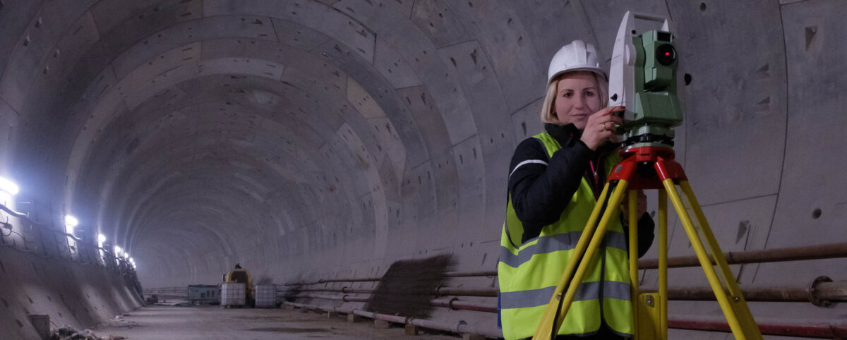
Static LiDAR
Collecting assets inside buildings, through intersections, on bridges, and on the ground—Static LiDAR (Light Detection and Ranging) measures and records asset data at a precise, granular level. The efficiency and methodology of Static LiDAR provide increased clarity for more complete and valuable data.
Since the information stored details your assets accurately, Static LiDAR applies best for transportation and construction applications, improving asset insights and decision-making for operations and maintenance planning.
Mobile LiDAR
Mobile LiDAR scans roadways and other infrastructure assets with extreme accuracy and cost-efficiency. With a vehicle traversing highways, roads, and bridges, Mobile LiDAR provides detailed data on elevation, pavement conditions, guardrails, road signs and more:
- Street and highway conditions
- Landscape and transit elevation
- On-the-ground data
- Bridges, tunnels, slopes, and fences
Transportation and construction managers find great utility in this powerful mapping method, covering up to 50 miles of right-of-way every day.
Aerial Collection
Using planes and helicopters, aerial collection captures exansive plots of land by scanning and storing data without street-level detail.
Helpfully, anyone can access aerial collection data in their state since each makes this information public. While it is less detailed than LiDAR data (which most states do not publish), this format is used across industries:
- Mining
- Gas and Oil
- Agriculture and Forestry
- Infrastructure and Utilities
- Emergency and Disaster
- Construction Sites
- Corridor Mapping
When you use this broad data in combination with sharp LiDAR collection methods, you’ll benefit from a global and granular assessment of your assets.
Drone Collection
Data on some assets can by difficult to collect. In some cases, data collection would block accessibility to the asset itself, present a safety issue or is simply inaccessible.. Drone collection offers a way for companies to still collect miles of asset data and related functions in the following industries:
- Mining
- Gas and Oil
- Agriculture and Forestry
- Infrastructure and Utilities
- Emergency and Disaster
Speed through Asset Collection with PILLAR (and Save)
Committed to client safety and satisfaction, PILLAR provides quick, quality data to infrastructure professionals, by tailoring the data collection solutions and recommendations for public project improvements. Our meticulous approach promises accuracy and efficiency, and our extensive expertise means clients save time and money through our proven asset management process.
Contact PILLAR at info@pillaroma.com or (276) 223-0500 to leverage our advanced technologies and optimize your operations and maintenance plans.