Categories
Save Money Save Time

The Value of Point Cloud Analysis for Transportation Infrastructure

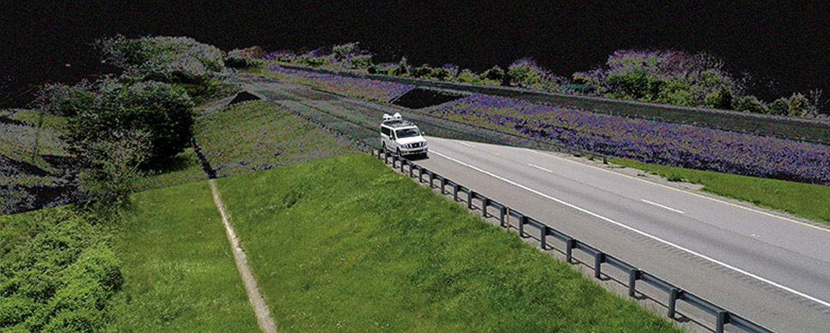
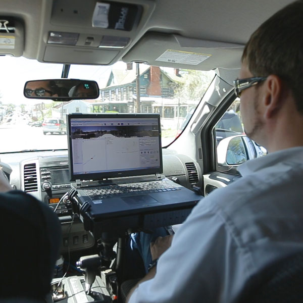
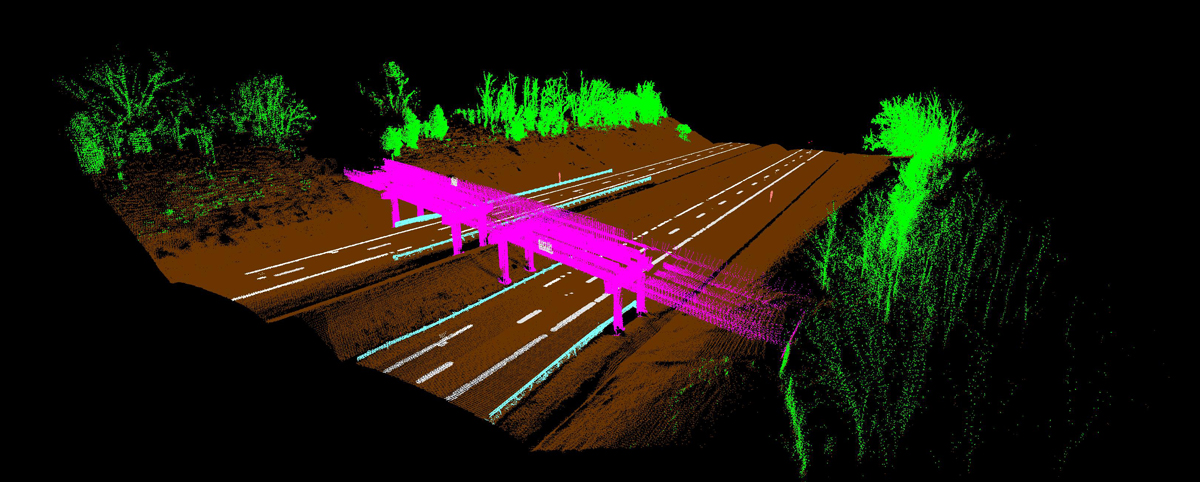
Effective transportation infrastructure asset management starts with understanding your full inventory of assets and their condition. The resulting point clouds from Mobile LiDAR provide a clear picture of your transportation assets and their condition to make data-driven decisions quickly and cost-effectively.

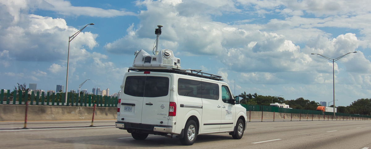
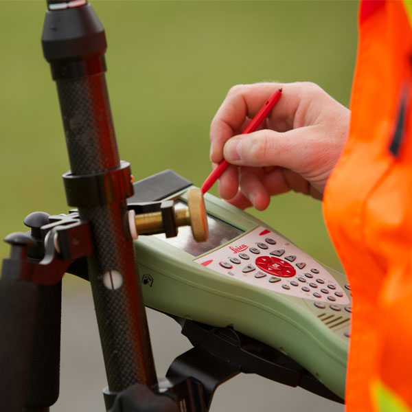
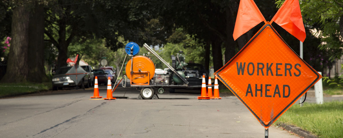
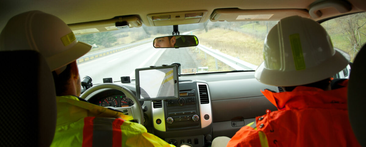
Mobile LiDAR captures roadway and infrastructure assets at posted speed limits, thereby collecting data at a fraction of the time it takes traditional surveying methods.

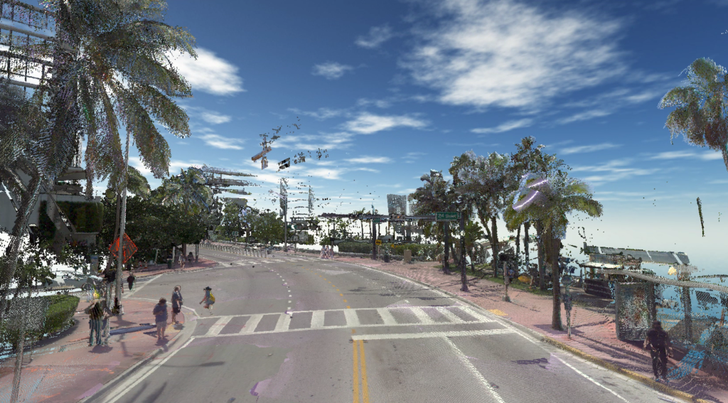
Mobile LiDAR creates 3D point cloud models that are precise depictions of roadways and infrastructure. These give unparalleled accuracy in establishing relationships between your data points, revealing their true position and condition.

Maximizing the Value of the Point Cloud with PILLAR

PILLAR’s Mobile LiDAR service takes the significance of the point cloud to the next level with its proprietary Fully Automated Feature Extraction System (AFES) that instantly extracts features and attributes (such as height, width, text, etc.) as data is processed. Machine Learning, AI, and Computer Vision are incorporated in the processing of this data with outputs to standard GIS formats, Shape files, geodatabases, and more.

Gone are the days of spending countless man-hours scrolling through pictures overlapped on the point cloud, pointing a cursor, and clicking on the asset to spatially link the two. Rather than traditional “point and click” semi-automatic extraction, Mobile LiDAR with AFES means fewer days to completion of your global view.

Decisions Backed by Data

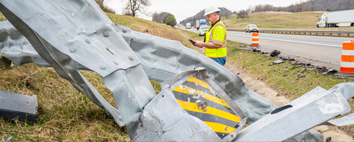
Without a global view of your assets and infrastructure, it can be difficult to make decisions for asset managers to justify funding for projects and programs. Tasked with managing hundreds of assets, some organizations are unaware of more hidden assets such as pipelines, drainage systems, and paved ditches. This can account for poorly mismanaged asset maintenance, costing agencies thousands of dollars.

A point cloud analysis powered by PILLAR AFES gives decision-makers the ability to provide asset data across various departments and stakeholders, integrating databases and streamlining processes to cut time and share costs. With a geospatial inventory, transportation agencies can determine priorities and set those priorities with a ROI-focused approach.

Applications for Mobile LiDAR and Point Cloud Analysis

Mobile LiDAR and Point Cloud Analysis help departments of transportation and localities make data-driven decisions to effectively manage the state’s transportation assets. Applications of this technology also serve as a valuable tool for emergency planning, disaster response, and community resiliency in the face of climate change. Infrastructure plays a significant role in these efforts, creating a need to better manage and invest in infrastructure improvements.

With PILLAR’s AFES, data can be instantly extracted and processed as 3D environmental models – increasing efficiency, transparency, and better planning.

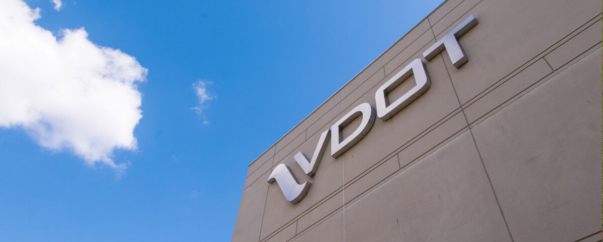
An innovative application of Mobile LiDAR with point cloud analysis for mowing management won the Virginia Department of Transportation – Staunton District the Environmental Agency Award. In collaboration with PILLAR, the team discovered it could allocate thousands of mowing acres as stormwater pollutant offsets. The discovery led to a 15,800-pound reduction in nitrogen, saving VDOT about $12.8 million in mitigation projects and nitrogen-credit purchases.

PILLAR Point Cloud Analysis in Miami, Florida

Save Time, Save Money, Save Lives

With the advances in surveying technology like Mobile LiDAR and point cloud analysis, asset management firms can help deploy effective asset management plans that will save time, save money, and save lives. PILLAR is trusted by departments of transportation that manage some of the largest state-maintained highway systems in the country to do exactly that. We help organizations make value-based decisions that proactively manages risk for the long-term needs of your asset base.

Contact us at info@pillaroma.com or (276) 223-0500 to discuss your asset management plans with a PILLAR expert.

Categories
Save Money Save Time

LiDAR-Based Mapping Method for Mowing Management Earns VDOT-Staunton District Environmental Stewardship Award

An innovative application of LiDAR-based mapping for mowing management implemented by the Virginia Department of Transportation -Staunton District is saving the agency millions of dollars annually by converting interstate rights-of-way into pollinator habitats. The innovative program just earned VDOT’s Staunton District the coveted agency’s Environmental Stewardship Award.

VDOT’s Staunton District Roadside Manager Scott Nye and Interstate Maintenance Contract Administrator Guy Tyrrell needed a better way to track vegetation mowing so they collaborated with PILLAR Operations & Maintenance Advisors to develop a solution.

PILLAR worked with Tyrrell and Nye to leverage LiDAR-based mapping and PILLAR’s proprietary automated feature extraction (AFES) software to quickly and efficiently identify VDOT acreage that requires mowing. The approach provides a highly accurate way to measure and track mowing costs and allows quick and easy adjustments to mowing operations. More importantly, the data from the LiDAR mapping method enabled the team to see a  better solution– a large percentage of the interstate rights-of-way could be set aside for pollinator habitats without compromising public safety or roadside aesthetics.

The Staunton District has now allocated more than 5,100 acres of mowing operations to only once per year in the fall. This acreage set aside as meadow can be transplanted into stormwater pollutant “credits” to support the total maximum daily load pollutant reduction requirements VDOT’s MS4 permit. The conversion of mowed turf into a meadow condition equates to a 15,800-pound reduction in nitrogen that would otherwise reach the Chesapeake Bay, saving VDOT about $12.8 million in mitigation projects and nitrogen-credit purchases.

Learn more about how Pillar can work with your DOT or municipality to see the bigger picture and develop cost-efficient transportation asset management solutions.

Categories
Save Face Save Lives Save Money Save Time

Mobile LiDAR Improves Safety By Reducing Need for Work Zones

Transportation surveyors are frequently exposed to significant danger from traffic as they work to collect the asset data required to maintain, build, or repair infrastructure.

The Bureau of Labor Statistics reported that transportation incidents accounted for 76% of roadway work zone fatal occupational injuries between 2011 and 2017. In 60% of these transportation events, the worker was struck by a vehicle in the work zone.

Clearly, roadway operations and maintenance require a safer, accurate, and efficient way to collect infrastructure asset data.

Reducing Traffic Exposure with Mobile LiDAR

A Mobile LiDAR scanning system is the efficient way to inventory transportation assets and their condition at highway speed, eliminating the need for a static work zone that impedes traffic flow as surveying staff conduct their work. Instead, Mobile LiDAR collects data from a vehicle driven at posted speed limits and creates a digital 3-D representation of existing road conditions within the right-of-way.

Mobile LiDAR scans the conditions of infrastructure assets like pavements, guardrails, mowing acreages, bridges, highway signs, and more. Mobile LiDAR takes transportation asset management to the next level, collecting massive amounts of data with speed, precision, and cost-efficiency. Complete surveys in a fraction of the time it takes with traditional survey methods and yield higher quality data for optimal operations and maintenance plans.

Advantages of Mobile LiDAR

  • Easily identify the location of all your transportation assets.
  • Gather robust data while mitigating exposure to dangerous working conditions for employees.
  • Avoid the extra cost and man-hours that come with work zones.
  • Reduced exposure to road accidents and other roadway related injuries.
  • Advanced collection methods ensure accurate asset data and rapid data extraction.
  • Integrate asset data with existing databases and workflows.

Minimize Employee Risk and Maximize Productivity With PILLAR

With advances in surveying technology, the transportation industry is investing in innovative asset management solutions to improve operational efficiencies, optimize budgets, and ensure employee safety in the field.  

As a transportation asset management firm, PILLAR houses advanced technological solutions like Mobile LiDAR, drone aerial collection, street level imagery, and geospatial inventory to locate your assets and identify their condition. Our robust approach to asset management merges technology with specialist expertise to optimize, develop, and execute tailored asset management plans to secure O&M funding and improve the service level of all infrastructure assets.

Partner with PILLAR today and discuss with our experts to figure out the best way to augment your staff safely, reduce traffic interference in your communities, and collect transportation asset data quicker and more accurately than ever before.  

Contact us at info@pillaroma.com or (276) 223-0500 to discuss our Mobile LiDAR solutions and more.

Categories
Save Lives

Drive Safe, Work Safe, Save Lives

National Work Zone Safety Awareness Week is April 26 – 30

National Work Zone Awareness Week, April 26-30, is a timely reminder for motorists to stay alert for DOT and other workers. In 2020, work zone crashes and fatalities increased, despite lower traffic volumes due to COVID-19.

Distracted Driving Costs Lives

Even a small mistake by a driver or worker can be disastrous in and around a highway work zone. Highway workers are in a high-risk category, but statistically, motorists are even more at risk. According to the Federal Highway Administration (FHWA), most fatalities in work zones are motorists, not highway workers. The National Work Zone Safety Information Clearinghouse – which collects federal data – reported that in 2019, there were over 760 work zone fatal crashes that resulted in 842 deaths.

National Efforts to Increase Work Zone Safety

To combat this significant public safety issue, 48 states have banned text messaging for all drivers, while 25 states, including Virginia, prohibit all drivers from using handheld cellphones while driving. Using a handheld cell phone while driving, and especially in a work zone, can be a deadly choice.

Defensive Driving Tips for Work Zones

  1. Stay focused and alert in a work zone: DO NOT use a cell phone, change the radio, eat, apply makeup, or create a distraction from the road.
  2. Research your route. When possible, try to avoid work zones altogether and use detours when available. 
  3. Lane closures and reduced speeds are common in work zones. Slow down when entering a work zone and pay careful attention to the presence of workers and machinery.
  4. Move into an open lane as soon as possible when approaching a lane closure. Remember to pay close attention to other vehicles around you, particularly in your blind spot.
  5. Avoid trucks of all types when possible. They usually have limited visibility and cannot maneuver as well as smaller vehicles. Give them a lot of room in all driving situations.
  6. Because rear-end crashes are the most common types of collision in work zones, always maintain extra following distance between vehicles. Four seconds is the recommended following distance.
  7. Turn on your headlights, even if it is not required by law. It is good ‘driving practice’. Headlights ‘on’ is the equivalent of wearing a high visibility vest on your vehicle. This helps other drivers identify your presence.

Be Alert. Risks Abound Outside Work Zones

The risks and challenges associated with highway travel are not confined to defined work zones. There are numerous other activities on a road that can easily create impairment to safe travel, such as mowing, litter pick up, snow & ice control, law enforcement activity, animal hazard, standing water, pavement defect (i.e., pothole), etc.

While work zones are usually well marked with signage and devices, most of these other impairments offer minimal advance warning to motorists. The combination of ‘Boots on the Ground’ (that would be Pillar!), a distracted or impaired driver, failure to reduce speed or any of the other risks noted above can prove to be costly, if not deadly, if you aren’t paying attention.

When transiting work zones, remember to be patient and stay focused.

PILLAR employees and other work zone crew members across the nation diligently strive to improve our infrastructure and make the roads safer for everyone. Join PILLAR next week as we raise awareness for work zone safety.

Categories
Save Face Save Lives Save Money Save Time

Transportation Asset Management: A Vital Tool In Community Resiliency Efforts

In recent years, local municipalities and the federal government have invested millions to make their cities more resilient and prepare for natural disasters, along with mitigating the imposing threats of climate change. Local and federal governments are realizing the critical role transportation infrastructure plays in assisting in disaster and climate adaption efforts and are searching for ways to increase community resilience, improve aging infrastructure, and decrease flood risks with transportation asset management.

Investing in Resilience and Sustainability

In 2017, the City of Miami passed a $400 million general obligation bond, with half of the investment funding community resilience, disaster, and climate relief efforts. This includes reducing flooding risks, mitigating rising sea levels, enhancing public safety, and improving infrastructure. As of March 2021, there are 7 on-going projects in the city to assess transportation assets and improve infrastructure.

In February 2021, the U.S. Department of Commerce’s Economic Development Administration awarded a $1.1 million grant to the Miami Conversancy District in Dayton, Ohio to protect communities from flooding and upgrade Dayton’s levee system. The grant is matched with a $276,254 local investment, all focused on supporting key infrastructure improvements in the Miami Valley.

Challenges of Resiliency Planning and Disaster Management

From mitigating flooded roadways to effectively planning emergency routes, community resiliency plans start with a comprehensive and accurate assessment of all transportation assets, including pavement condition, stormwater management systems, bridges, tunnels, signage, medians, and guardrails—just to name a few. 

A significant challenge for most asset management and disaster prevention systems is the lack of a reliable infrastructure asset collection, leading to delays in response time. In terms of the cost to human lives and properties, delays can be hazardous for disaster management agencies. A robust asset management and analysis system is required to ensure that the asset condition is properly assessed, so accurate insights for improving the asset are found.  

With lives at stake, effective transportation asset management requires industry expertise and next generation technology to make informed decisions based on data.

PILLAR’s Mobile LiDAR collects massive amounts of data with speed, precision, and cost-efficiency. This system helps us complete surveys in a fraction of the time compared to traditional survey methods. As a result, higher quality data is collected to develop effective emergency response and community resiliency plans and secure appropriate budgets for repair and ongoing maintenance.

With Mobile LiDAR’s fully Automated Feature Extraction System (AFES), data can be instantly extracted and integrated with existing databases – increasing efficiency, transparency, and better planning.

BE PREPARED WITH PILLAR

Municipalities across the nation are using transportation asset management data to better prepare and protect their communities against natural disasters and the imposing threats of climate change. This is where PILLAR comes in. Equipped with the best asset management experts and advanced technology, PILLAR efficiently collects transportation asset data, accurately assess asset conditions, develops, and executes asset management plans to maintain and optimize their performance against climate change and natural disasters.

As a transportation asset management firm, we help organizations save time, money, and face (by preventing public outcry in the case of a disaster). Partner with us today and help the communities that you serve be more resilient.

Contact us at info@pillaroma.com or (276) 223-0500 to discuss your asset management plans with a PILLAR expert.

Categories
Save Face Save Time

Transforming Geospatial Data: The Power of Geomatics

Technology is revolutionizing and transforming geospatial data. Going far beyond your typical data point collection and measurements, we can use evolving geospatial tools such as LiDAR, GPS/GNSS, and remote sensing to collect comprehensive and multi-dimensional geographic data. This data is extracted and analyzed to make data-driven decisions in the development of transportation asset management plans. 


The incorporation of these technological tools has created some confusion in the geospatial industry causing the coining of a new term, Geomatics. Geomatics has entered our lexicon to cover the multiple ways and uses of the data derived from these geospatial tools by various disciplines.

Pillar uses these advancing technologies to yield enhanced efficiency and results. Read on to learn more.

The true and sometimes subtle differences between geospatial differences create confusion. Today, those differences grow even finer as mobile mapping, asset management, and unmanned aerial vehicles become integrated in daily operations.

Defining Geospatial: More than an object

Surveying Device

Using the term geospatial indicates that an object or object set has a geographic component to it. Typically, this geographical component is identified in terms of coordinates (latitude, longitude, altitude). However, it can also relate to an addressed location such as a house number on a street in a specific city in a specific state or zip code. Most of the time the geographic component is attributed through global positioning system (GPS). However, satellite imagery or photogrammetry can be utilized to derive the geographic component.

Defining Geographic Information Systems (GIS): Controlling Ever-Growing Geospatial Data

Surveying Device Folded

Geographic information systems (GIS) manage, store, and integrate geospatial data collected from:

  • Satellite imagery
  • Demographics
  • Statistics
  • Road networks
  • Historical maps
  • Investigation, etc.

The information systems cataloging these data points helps professionals manipulate, analyze, and map their geospatial data. Through GIS, you can view, analyze, and house multiple layers of information to perform various volumetric and area calculations, create maps, and perform various types of modeling.

Since geospatial data is ever-growing, GIS becomes an essential tool for the management of valuable data for project planning and improved efficiency of research. But, when one goes beyond the collection and storing of important geospatial data, they enter the multidisciplinary science of geomatics.

Defining Geomatics: Going Beyond Geospatial Data with Interdisciplinary Science

Pillar Mobile LiDAR Screen in Vehicle

Many people describe a wide selection of geography-relevant technology and disciplines as “geospatial.” However, “geomatics” involves more specifically the sciences of:

  • Surveying
  • LiDAR
  • Cartography
  • Satellite navigation
  • Photogrammetry
  • Mapping, etc.

While these are all excellent geospatial methods with formal procedures, geomatics also includes other sciences seemingly divorced from geo-inquiry such as:

  • Computer science
  • Mathematics
  • Engineering

To put it more simply, geomatics synthesizes spatial information with scientific application. It concerns the measurement of the Earth and technologies that help you act on that information. Geomatics goes beyond mere data to solve complex infrastructure problems with the latest technology.

Pillar is a dedicated transportation asset management firm focused on collecting, analyzing, and turning data into decisions for transportation infrastructure.

Our proprietary CAPE® approach for asset management integrates geospatial data with geomatics to optimize and execute operations and maintenance plans for infrastructure organizations.

Asset Management Experts

PILLAR is the only asset management firm whose core business is dedicated to maximizing the lifecycles of your assets – delivering asset data that informs operations and maintenance decisions at every step of the process. We use your existing data to extend the life of your assets for roadways, bridges and tunnels. We assess data availability and accuracy to give you an operations and maintenance plan developed to optimize budgets and timelines.

At PILLAR, we’re ethically and completely committed to the safety and satisfaction of the public. We give unbiased and evidence-based recommendations and solutions for the improvement and maintenance of roadways.

Contact us at info@pillaroma.com or (276) 223-0500 to get started with the only asset management focused firm merging industry expertise, next-generation technologies, and commitment to public safety.

Categories
Save Face

VDOT Awarded Pillar Statewide Maintenance Consulting Services Contract

The Virginia Department of Transportation (VDOT) awarded Pillar the contract for Statewide Maintenance Consulting Services for the third consecutive time.

The Statewide Maintenance Consulting Services contract was established so VDOT can call on experienced firms for Roadway Maintenance Consulting and Staff Augmentation related services. It provides for additional support for Maintenance Contract Development and Management, Roadway Inspection Services, the Development of Manuals, Standard Operating Procedures, Reporting, Quality Assurance and any other non-professional service of Virginia’s Roadway Maintenance Planning and Development Program. While it is administered by the Maintenance Contract Management Program section in the Maintenance Division at Central Office, the contractor is expected to work at any location statewide.

Over the past two contracts covering the previous nine and a half years, we have developed a trusted partnership with VDOT by bringing maintenance consulting and staff augmentation services in eight of the nine VDOT districts with over 96 task orders completed throughout the Commonwealth.

We look forward to working at length with VDOT as our new contract spans for 3 years, with a 2-year renewal option. The entire Pillar team is eager to support and enhance maintenance operations throughout Virginia in our valued partnership with VDOT. Discover what Pillar can do for you and contact us for a comprehensive program review.

Photo Source: VDOT Instagram

Categories
Save Lives

Work Zone Safety Week 2020 – In the Time of Covid-19

Despite the sharp drop in traffic volume, work zone activity does not relent. And it remains as dangerous as ever. Distracted or impaired drivers are still on the road. In our role as highway workers, the risk is clear and unmistakable.

We have tried to educate and inform our staff about these risks. Most of us have a distinct appreciation for the hazard. It starts with basic Defensive Driving and Defensive Positioning. When we are outside the vehicle in a highway setting, the risk is amplified exponentially. We know that a protective distance and position is our best defense when boots are on the ground.

Achieving this protection is easy to say, hard to practice. Each year there are triple digit fatalities in and around work zones of all types. They are uniformly preventable by workers and motorists.

Our society is basically suffering from two illnesses. The Covid Pandemic is the 800 lb. gorilla in the room right now. But it will recede eventually. The other illness is more insidious – poor driving skills by motorists, focused on all kinds of things, except Defensive Driving.

 This illness is going to be a lot harder to control. In the rather sterile parlance of the US DOT, the class of “Unprotected Highway Users” includes pedestrian, bicyclists, motorcyclists, and US. Highway work zone ‘boots on the ground.’ The statistics for this class of ‘highway users’ are heading north at an eye-popping rate.

Symptoms of this illness include: oversized vehicles, cheap gas, distractions, generous speed limits, and poor driving skills. The result is pretty hair-raising for a pedestrian. Most of whom are not exactly blameless in this picture: wearing dark clothing, looking at their cell phone, bikes encroaching into travel lanes, etc. The end result is not good.

In summary, we know what the cure for this illness is. Defensive driving, high-visibility apparel, defensive positioning, focused attention on the driving equation, and a few other situational survival skills. Boring as they are, that’s the medicine. We can beat the Covid. That’s already in the works. The other illness is going to a lot harder to treat.

This week we remember the Highway Workers who sacrificed their lives in the interest of keeping roads safe. Their memory should inspire us to practice safety skills in all walks of life.

Categories
Save Face Save Lives

O&M IS Critical Infrastructure

During these times of uncertainty, we have all heard the call from our respective Governors about “critical industries” such as healthcare and first responders. Our infrastructure is also “critical”. As for Maintenance: Rust doesn’t stop, potholes still form, debris doesn’t stop building up, trash and debris continues to accrue. As for Operations: the trucks, busses and automobiles that keep it all moving are still out there. Motorists will need our help, meaning the Safety Service Patrol (or whatever it is called in your state) must continue – all while maintaining our “social distancing”. Electronic tolling is increased, as most states have removed human toll takers due to the obvious concerns with viral transmission.

We have noticed that while automobile traffic has subsided, truck traffic is still present, if not increasing. Our clients have seen this lower traffic volume overall and decided to take advantage of the lower traffic volumes by INCREASING the amount of preventive maintenance by extending or lifting lane closure restrictions.

While future state budgets will undoubtedly be affected, we must continue to maintain our assets, even during an impending budget crunch. If not, as we have seen time and again, the cost to play catch up will be multiple times the cost of doing it right while we can.

Categories
Save Lives Save Money Save Time

Pillar Partners With Rose-Hulman Ventures

Rose-Hulman Ventures recently featured PILLAR and reviewed our patented salinity measurement device, SAM. PILLAR President Mark Boenke, shares his expertise on how SAM will reduce harmful salt usage on public roads and highways. Boenke partnered with Rose-Hulman Ventures back in 2017 when PILLAR was trying to find the best materials to use for the SAM device that would not be damaged by the highly corrosive saltwater. SAM was first developed by Mark’s daughter, Bridget, as her high school senior year science fair project!

SAM is a salinity measurement device that reads the salt concentration, via electrical conductivity, in the water spraying off of the salt spreader’s back tire. If the salt concentration levels are too low to prevent the forming of black ice, the driver is notified to apply more salt. If concentration levels are adequate, the driver is notified that no additional salt is needed.

PILLAR hopes to bring SAM to the market by 2021. Be sure to check back in for updates on SAM’s release and all of PILLAR’s projects!

Read the full article.