Categories
Save Face Save Money

What does Rehabilitation mean for a Public-Private Partnership?

A Public-Private Partnership (P3) is a contract vehicle where a private developer – working with a public entity – designs, builds, finances and operates the infrastructure. This Pillar Talk will focus on the rehabilitation, or handback portion, of a P3.

P3 transportation projects have two varieties: availability payment or revenue risk.

In an availability payment model, the public entity pays a fixed amount on a monthly or annual basis, usually after making some larger “milestone” payments during or at completion of construction. The funding could come from general transportation funds, a bond issue or indirectly from tolls generated from the new roadway but retained by the public entity or any combination of these. An availability payment P3 is generally of shorter duration, generally 25 years.

A revenue risk project is funded directly by toll revenue generated by the facility. The developer takes on much more risk and is not guaranteed any level of funding from the public. Unless the public entity “buys down” the tolls by injecting cash, there is generally no “milestone” payments during or after construction. Due to these risks and funding variables, the revenue risk project duration is usually much longer: Often 50 years but it could be up to 75 years or longer.

Once the project is complete, it is turned over to the public entity. To ensure the public entity receives an asset in good condition, certain “handback” requirements must be met. The rehabilitation process is the manner in which the developer meets these requirements. The requirements are usually limited to major assets, such as pavements and structures.

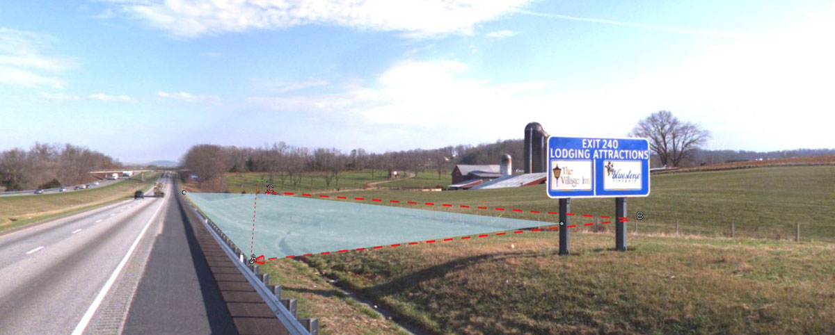
Handback requirements generally require an asset be in a certain condition or have a set number of years of remaining service life on handover. For example, pavements could be required to have a maximum IRI or have structural capacity requiring no more than a 2” overlay within 10 years. Bridge structures may have to meet an NBIS rating of “7” or better.

Other items such as sign structures or high mast light structures may require 15 years of remaining service life. A high mast light structure may have a design life of 40 years. On a 25-year project, it would not need to be replaced. On a 50-year project, it would likely be replaced in year 40.

Longer projects tend to have lower handback requirements – this allows the project to be more affordable as it will likely be too expensive to expect a “brand-new road” be given back to the public at the end of the term.

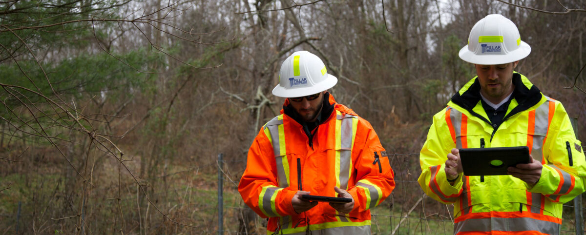
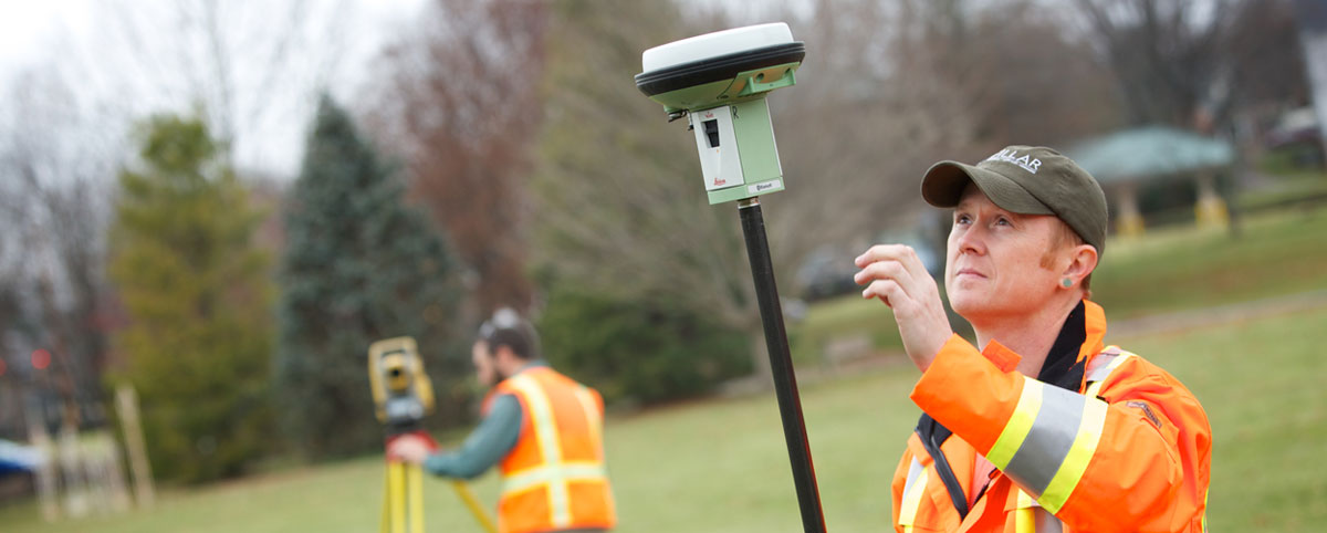
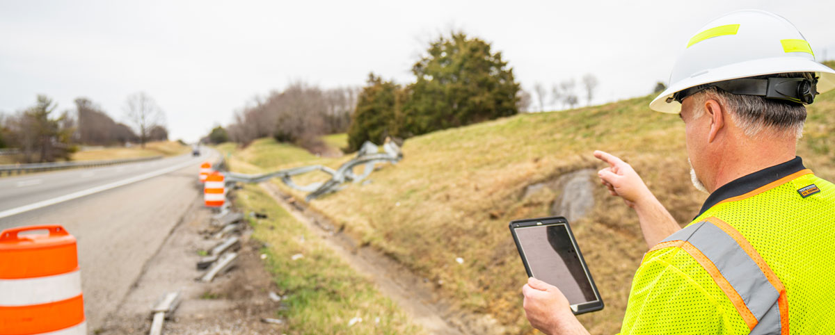
To ensure the asset is in acceptable condition, a series of inspections will occur over the last five years of the project. The inspections would be made by an acceptable third-party engineer, with reports and recommendations made as to what the remaining service life is projected to be at project end. Some projects will have an escrow account where the developer sets aside money to guarantee funds will be available to complete the rehabilitation, with any remaining funds at handback kept by the developer.

Pillar, Inc. can help developers and owners understand the potential costs of handback requirements and can assist with bid-level budgets that ensure a quality asset is returned to the public. For more information, call 276.223.0500 or contact us online.

Categories
Save Face

Is Your Agency Maximizing Asset Management to its Fullest?

Last month I attended the 12th TRB Asset Management Conference (my third) and the 2018 AASHTO Committee On Maintenance Annual Meeting (my fifth).

While both conferences were about Asset Management, the focus of each was on two different planes. The TRB Conference focused more on strategic issues (i.e. risk, resiliency, sustainability) and the AASHTO Conference focused more on tactical issues (i.e. equipment, materials, technology, regulations). Asset Management has gone through a significant evolution from a tactical focus on operations and roadside maintenance to a powerful strategic management tool that enables agencies to better plan, manage and execute to maximize results and be more cost efficient.

The Evolution of Asset Management

In its infancy, Asset Management was more tactical, defined by how an agency’s operations and maintenance (O&M) staff managed the maintenance and upgrading of its physical roadside assets.
Over time, Asset Management has become more strategic – utilizing business and engineering practices and processes strategically and systematically to operate, maintain, and upgrade all assets by maximizing resource allocations. Ideally, this is conducted through decisions based on quality information and well-defined objectives throughout the agency.

Knowing How to Maximize Results

The maturation of Asset Management – along with other factors such as aging infrastructure, decreased budgets, higher accountability, and workforce attrition – has resulted in a fundamental shift in operations.
Agencies need to know and examine what they have (collect and condition assess assets) and what they can do with their money, people, equipment, and contracts (analyze and prioritize) to create a plan which maximizes results and comes closer to achieving their objectives.

Importance of Strategic Planning

No longer is Asset Management defined as O&M field personnel managing roadside items, but as a business practice for an agency to manage its entire asset collection (people, materials, equipment, and contracts).

Subsequently, strategic planning at a higher organizational level is becoming the more dominant and prominent feature of Asset Management. If not managed properly, this can cause a gap within an agency between the planners (office) and operators (field) placing each on different planes.

PILLAR Bridges the Planner-Operator Gap

Planners rely on the field data to model and develop the objectives. O&M field personnel rely on the same data to review, manage, locate, and execute the work to meet objectives. Therefore, Asset Management and Maintenance Operations are interconnected through quality field data. Planners and operators need to work with and understand each other and how to use the data to become coplanar. One cannot be subservient to the other.

This is where PILLAR can help. Our staff of professionals have been involved with Asset Management from its infancy and with Maintenance Operations for many decades. We understand the pitfalls and challenges faced by agencies developing and implementing their asset management plans.

PILLAR can and has helped gather the data utilized in developing and executing well-defined objectives. We collect, assess, analyze, and prioritize data through a variety of means and methods – enabling agencies to transition and mature with their Asset Management program.

We bridge the gap between planners and operators by combining our engineering background with our practical field experience. This translation not only advances but also strengthens an agency’s interconnection between planners and operators.

Contact us to discuss how we can strengthen your agency.

Categories
Save Face Save Money Save Time

Mobile LiDAR’s fully automatic asset extraction capability sets it apart

Modern technology has catapulted the maintenance of roadway infrastructure to a new level.

When it comes to collecting data about your assets, PILLAR utilizes the Leica Pegasus: Two Ultimate as its choice for mobile LiDAR. The laser scanning and mapping technology platform provides what we need to get the job done.

This device utilizes two back-to-back cameras to create 360-degree images from a vehicle, boat, 4-wheeler or train. A removable SSD means you have the information at your fingertips when you walk into the office.

Fully automatic feature extraction

Semi-automatic feature extraction is good. Fully automatic feature extraction is the best, quickest, and most helpful. It allows you to get started on projects as soon as possible.

Using our full automatic feature extraction program, we can extract assets and their quantities quickly and accurately. If saving time appeals to you, contact us to see how much time we could cut out of your project and add back into production.

More than 20 assets can be extracted into your own geospatial information system. This comprehensive transportation infrastructure management application includes:

  • Signs
  • Guardrails
  • Bridge Clearances
  • Trees
  • Ditches
  • Overhead Utilities
  • And More

Collection and Execution

The information collected provides the most detailed data possible on your assets, helping you determine what you have and where it is located. This information can then be used to identify which work needs to be given the highest priority, helping you work within your budget.

InfraTrak is a GIS system asset management application agencies purchase as an additional tool to better manage assets. It is an iPad-based app with a GIS interface, able to overlay assets on aerial maps for an interactive set of field plans. InfraTrak is completely compatible with the most popular GIS software such as Esri’s ArcGIS software and many others.

For more information on PILLAR’s Asset Management Solutions, contact us or call 276.223.0500.

Categories
Save Face

PILLAR sponsors storm water management program for Leadership Roanoke Valley

PILLAR demonstrated its commitment to environmental issues by sponsoring a storm water program for the Leadership Roanoke Valley.

Mark Boenke, President of PILLAR, agreed to sponsor the event that educated Roanoke citizens about the operations and maintenance of stormwater runoff.

The event was based around the following objectives:

  • Recognize the challenges that the Roanoke-area has with storm water infrastructure
  • Identify the roles government, citizens and businesses have in storm water management
  • Apply mitigation strategies in attendees’ personal and professional spheres of influence

Here are several facts about Roanoke’s storm water runoff system:

  • 774 storm drain outfalls in the city empty runoff (trash, oil, sediment makes its way into streams) directly into streams
  • A 1,600 square-foot home sheds almost 1,000 gallons of water in a 1” rainfall
  • The annual runoff from one acre of a paved parking lot generates the same amount as 36 acres of forest or 20 acres of grassland
  • More than 1,400 tons of debris was removed from the city’s streets in 2017

Properly managing water runoff to protect the environment is one area that PILLAR is particularly passionate about. The company’s staff regularly helps its clients lengthen the life of storm water systems for highways, municipalities and public-private partnership projects.

Leadership Roanoke Valley was created in 1983 to foster community leadership in the region. The interactive 10-month program encourages participants to use creative ideas and approaches to address business and community issues.

Categories
Save Face Save Time

What does the “O” mean in Roadway O&M?

We understand generally what roadway operations and maintenance is: everything it takes to care for and operate the roadway while keeping it safe for the traveling public in the short- and long-term. We use the terms “operations” and “maintenance” together as if they are inseparable. For most projects, they are. They occur simultaneously.

But what exactly are operations? Can they be separated from the maintenance?

WHAT ARE OPERATIONS?

Operations consist of a suite of services that are distinct and can be separated from maintenance. Operations can be further defined by the following major services: Snow and Ice Control (S&I), Incident Management (IM), and Courtesy Patrol/Towing (CPT). This paper does not include Toll Operations, which is a separate and distinct discipline.

INCIDENT MANAGEMENT

IM is any response to an abnormal situation on the roadway which includes man-made situations (accidents, terrorism or other law enforcement activities), major weather events, or sudden failure or damage to the road. Most items require basic or complex traffic control installations and detours. Large crashes involving commercial vehicles can include hazardous materials spills, damage to infrastructures, and prolonged cleanup times.

SNOW AND ICE

S&I is just what it sounds like: removal of snow and/or ice to make the roads safe to use. The work generally consists of plowing snow and spreading salt, sand or various liquid anti-icing chemicals. Depending on the climate and expected snowfall, the work may include heavy equipment like motor graders, snow blowers and rubber tire loaders.

COURTESY PATROL/TOWING

CP/T generally includes providing a fleet of well-equipped service trucks and trained staff to help stranded motorists by providing fuel, water for overheated radiators, jump starts or simply pushing a vehicle out of a lane and into a safe area such as the road shoulder. The frequency and duration of the patrolling will be specified in the contract performance section and is usually limited to peak travel times.

WHY SEPARATE?

While all these services are usually provided under the “operations” mantra, they can be removed all together or included as separate parts.

Some owners are reluctant to give control over to operations services. This may be due to poor experiences with outsourcing or the belief that poor service and negative publicity is undesirable, so the service must be retained by the owner. Another reason may be that the owner already provides a successful, integrated Courtesy Patrol and Incident Management service and wants to continue providing it.

The decision to outsource or retain the various operations services is ultimately the owner’s, but careful consideration must be given to the total cost as well as the risks involved with these decisions.

Want to learn more about operations and maintenance? Contact Us.

Categories
Save Face

Surveying Science Marches On

 
Since the days of Thomas Jefferson, the science behind mapping and surveying has continuously evolved. In those days, high tech meant a brass compass placed on a staff, or maybe a fixed leg tripod combined with a wooden stick or steel chain. This equipment had its limitations regardless of how careful the surveyor was. To put this into perspective, Mr. Jefferson would have measured an angle to the nearest degree with a device that was controlled by the magnetic forces of the earth, and horizontal distance typically to the nearest foot with a 16.5′ wood pole. To put in laymen’s terms, “there is some slop in them measurements.”

Today, a digital total station used by surveyors can measure an angle to the nearest 1 second of arc (60 seconds of arc in 1 minute and 60 minutes of arc in 1 degree), and distance to the nearest one thousandth of a foot. It’s like comparing calculating an equation using either your fingers or an HP48GX graphing calculator. If you told Jefferson you had equipment that could measure to that accuracy without even stretching a chain between two points, he and the other elders would have probably tied you to a post while they lit it on fire.

While surveying accuracy has dramatically improved, what hasn’t changed is the purpose behind mapping and surveying which is to identify a particular point on the ground. Additionally, regardless of what year it is – 1818, 1918 or 2018, – the same issues persist: missing monuments, title gaps and overlaps, encroachments, possession disputes, vague legal descriptions and on and on. A land owner usually doesn’t grasp how the science behind mapping and surveying relates to its purpose. Their sole understanding is confined within the little blue document they have in their hand that describes what they own (their deed). As a surveyor, it feels as though you hear the words “but my deed says” from clients no less than a million times during your career.

Recently, I heard these very words from a client who contracted PILLAR to retrace a boundary line along the east side of his 95-acre tract in some fairly rugged terrain. The title description was based on a physical survey performed in 1850 – yes folks, I said the year of our lord one thousand eight hundred and fifty (as written in this particular deed). He hired Pillar to do the survey because he did not agree with the boundary line previously establish by another firm.

All physical monuments as referenced in the description were destroyed over the last 167 years, leaving only two non-original markers at each end of the line in question. This client could not understand why the courses and distances didn’t match exactly what was stated in his deed. When physical monuments are missing, a surveyor must rely on these courses and distances to re-establish that boundary line. This is where the relative precision and accuracy of the equipment used when the original survey was performed must be considered.

If an original measurement was recorded as 45 poles between two points (remember 1 pole = 16.5′) and a modern surveyor produces a field measurement of 751.65′ between the same two points, try to consider the fact that the original surveyor was flipping a stick end-to-end up that mountain to produce a measurement.

After all, who knows what will be considered accurate and precise in the year 2184? I might just be the one who would tie you to a post…

Categories
Save Face Save Lives

Workforce Development & Your Company Culture

Understanding your employee demographics is a key attribute in a human resources program. It is a big part of what makes your organization tick, and getting it right can make a significant impact on your bottom line. Ask yourself if you plan on being in business five years from now, or 10?

In this brief space we offer tips and truisms that can help you manage the development process in the near and mid-term. If you haven’t noticed, the Boomers are retiring and the rules-based conformity mentality is going with them. The game has changed by an order of magnitude. In other words, the days of “Theory X Boss is Right” management are history.

Adjust your HR program and management approach

According to the Supreme Court, corporations are people. This judicial-political absurdity should be reflected in things like:

  • Regular company-wide family engaging events, (summer picnics, holiday parties, etc.)
  • Employee recognition programs
  • Refined and family targeted communications, suggestion programs, enlightened HR programs and policies, etc.
  • You may have been in business for 50 years, make sure your thought processes didn’t stay stuck in the comfort zone of the 80s.

Safety programs

These are often a good place to start the process because they are pretty much neutral territory and cover a wide swath of inputs.

  • Start an Employee Safety Committee, empower it, guide it but let the employees drive. Empower and enable it.
  • Put your name and logo on safety gear. In other words, own it!
  • Quit buying the cheapest PPE available, it sends the wrong message. The difference in cost in miniscule but the branding message is priceless

Don’t try to do everything alone

Inviting stakeholders to the party will help people feel as though their voice is being heard and that they can have an impact on the company.

  • This is also known as ‘Leadership,’ which is the gold standard in the safety and workforce development business.
  • Ideally, leaders should be developed through your ranks, not the want ads.

Peer Group Dynamic

This is a powerful tool when used properly, so make sure you review this process carefully.

  • Department managers are LEADERS first
  • Lead persons and working supervisors LEAD by example. They are the face of your organization – for both employees and clients.
  • Each employee must be recognized, respected, treated fairly and valued for their contribution to the group. Setting reasonable and achievable standards of performance and conduct is a basic element of this process.

Employee wellness

Promoting a healthy lifestyle is one of your best allies in developing your company culture. This means people who are relatively healthy are usually better workers, safer on the job, more productive, take less time off and return sooner following an illness or injury. In other words:

  • Offer wellness assistance such as smoking cessation; exercise and fitness initiatives, 5K walkathon sponsorships, dietary advice and encouragement, i.e. remove the soda pop from the vending machines, replace it with some kind of hydrating beverage, etc.
  • For the enlightened of our readers, offer health club memberships or discounts.

Refine your hiring practices

Post a job description that defines the necessary criteria for a successful employee not just for the job you are trying to fill, but for the longer range.

  • Configure some questions to determine if the applicant has an aptitude for self-study, learning, advancement, promotion or learning, etc.
  • This translates to: community college course work; membership and participation in trade associations; a track record of achievement; innovation, invention, etc.
  • When you hire ‘average,’ why would you expect any other result? It’s tough to be selective in an economy with 96% employment, but unless you are desperate (not a good sign), ramp up your criteria.
  • It’s not all about the money, but obviously you need to be competitive in the wage market. The peripherals we mentioned above can make a huge difference in how your employees perceive the culture and future of the people they work for.

Accommodate non-English speaking employees

Set up a simple version of English as Second Language (ESL) teaching.

  • A half-hour a week in the breakroom with a bi-lingual instructor can set up the dynamic.
  • You are not teaching physics, just the basics. Move the classes along based on aptitude and participation.

Carefully construct a company benefits program

These can often become the quick-sand of the HR program. Your program should at least match the industry average, as meager as it is.

  • If you can afford it, offer the buy-up option. As we know, this is an expensive outlay but try to configure it to show you’re at least trying to stay in the game.
  • This is also a highly a competitive playing field so unless you’re a math expert, use a trusted advisor to configure your employee benefits program.

Summary: Stay in business and grow

What we have seen is that the ‘C Word’ (CHANGE) has become ever more critical in the overall scheme of how a business is going to succeed.

We all can’t be General Motors, but we should be managing our enterprises according to best practices. These should be pointing more toward PEOPLE in the service economy, and people want to see their reflection in their workplace, not a number or a machine.

In other words, we should be looking to HUMANIZE versus mechanize.

Categories
Save Face

What is Geographic Information Systems (GIS)?

Have you seen the ‘what I do’ meme? What better way to explain Geographic Information Systems (GIS) than debunking all the perceptions?

What our friends think GIS is:
Often times, all our friends remember is that it has something to do with maps and maybe phones.

What our moms think GIS is:
Maybe it’s due to selective hearing, but many of our moms think we make GPS.

What the general public thinks GIS is:
Nearly 20 years ago it was a lot worse, but the general public thinks it has something to do with surveying. Not quite, but we have a division that can do that for you.

What our bosses think GIS is:
Although it would be cool, we don’t quite have matrix-like coding skills. We’re just glad they don’t want us to go into details and just let us keep doing awesome things.

What GIS professionals think GIS is:
We spend most of our days behind a screen, or three, because we keep way too many windows open at once.

What GIS really is:
All jokes aside, we focus on Geospatial Technology which is the backbone of Next Generation 9-1-1. Many people don’t spend much time wondering what happens when they call 9-1-1. Many assume the police, fire department and rescue units can locate us quickly and easily.

Unfortunately, that is not always the case.

Localities throughout the nation are working to make the best of what they have in their budget to obtain a more up-to-date system and better data collecting capabilities.

During our years of working with localities, we have focused on addressing their GIS needs. These needs often support departments such as planning, commissioner of the revenue, parks and recreation, and public safety.

In recent years, public safety has gone from being the smallest consumer of GIS data to the main consumer of GIS data.

Now, many localities are now starting to move to Next Generation 9-1-1. GIS serves an important role in the current E 9-1-1 environment, but with the graduation to NG 9-1-1, GIS will become not just important, but critical.

We spend time talking to clients, attending seminars and conferences, and keeping up with the advancements of GIS and NG 9-1-1. Despite all of the new technology that comes with NG 9-1-1, most of the needs localities have are based on workflow and communication

Categories
Save Face Save Time

Assessing The Condition of Your Roadway Inventory

Previously, we talked about the critical importance of maintaining an accurate inventory to support asset management. Knowing your inventory is just the first step in good asset management. It’s also important to know the condition of that inventory, which brings us to the next step, assessing your infrastructure inventory.

None of us is getting any younger, and neither is your infrastructure inventory. Just like our human bodies and vital systems change and decline with age, so does your inventory. We take care of our health by making periodic visits to the doctor to monitor our condition and find problems in their early stages. Imagine you have a bad knee. It may tell you when the weather is going to change, but it can’t tell you when it will need to be replaced. So you go to a specialist who monitors the knee and takes measures to extend its functionality. You may get some physical therapy, then try some shots, but eventually the joint will fail. There are increasing signs and symptoms that will continue to alert you to the problem, like pain or swelling, but the exact moment of the upcoming failure can’t be predicted. But if you’ve done everything you can to maintain that knee, you can delay the replacement for an extended period of time.

The same way you watch and take care of your knee, you need to assess and take measures to extend the lifespan of your inventory. Take pavement, for example. When it’s newly installed, the surface is nice and smooth and provides a comfortable ride. Over time, traffic and the environment begin to take their toll on that nice, smooth surface. Eventually, cracks will start to appear in the pavement, making the ride a bit less comfortable. Like a little ache in our fictional knee, this is your signal to pay attention and take some action. So we apply a crack sealant to help stop the cracking process, slow the overall decline and restore the pavement to a smooth surface.

This will work for a while, but as time and seasons pass, potholes will start to develop and the pavement starts to break apart around the cracks. Time to take action by filling the potholes with patch material, the equivalent of injections in that bum knee. The action is a bit more drastic, because your inventory is nearing the end of its lifespan. Just like the knee replacement, eventually you’ll need to repave.

Assessment Quote

Effective asset management begins with accurately assessing the condition of your inventory to identify the appropriate treatment. Knowing the optimal time to treat the problem will help to ensure your inventory is kept in good condition. This not only extends its viability, but keeps the lifecycle cost as low as possible. Just like you don’t get your knee replaced with the first little pain, you don’t want to repave after just a few cracks. Likewise, you can’t ignore the symptoms and just let potholes get out of control.

Gather as much information on your inventory as possible and you’ll have the basic data needed to make a complete assessment plan. Research all the appropriate service/maintenance contracts and budgetary constraints. Just like the doctor uses x-rays, scans and blood tests, inspect and monitor you inventory, then research your options. Knowing what remedial actions or replacements will be needed in the future will make it easier for you to accurately forecast trends and make better budget and program decisions.

Categories
Save Face

What Survey Plat Really Represents

Some people see a survey plat as an overpriced piece of paper but it’s not just a pretty picture. It represents hours spent reading moldy court records and digging through centuries of legal documents about a piece of land two people transferred back and forth….and back and forth. It represents the blood and sweat shed during days spent in the field in a seemingly endless search for property corners of the distant and not so distant past. Let’s not forget the hours spent compiling data, grumbling at field crew for busting a traverse (which mine never do by the way), interpreting deeds, head scratching, pencil throwing, and rants of profanity that all go into painting that “picture”.

You could compare a land surveyor’s plat to Joanna’s pieces of “Flair” in the movie Office Space. Do you just want to do the bare minimum, is it too much to ask for a few more pieces of “Flair” on your survey plat? A tie line to an adjoining monument used to help establish a boundary line, a crooked junky old fence that wiggles in and out along a boundary line, a creek, a witness marker to help me find a ½” tall iron rod in 2′ of leaf debris in the middle of the woods. Something!

Now I’m not saying that I’m the Rembrandt of the cartography world nor am I the Peter Messier of the land surveying profession, but I’d like to think that I paint a pretty good picture of what we find during the preparation of a survey. I do this not just for our clients benefit but also for the benefit of the “ME’s” of the future. To help the next poor guy that aspires to be a land surveyor find that ½” iron rod that was set in that pile of fence wire that just happens to be where the property corner was. Help them understand through your “art work” how in the world you came up with the opinion that you developed and felt comfortable enough to hang your professional hat on.

If you are a property owner and a surveyor is handing you the final product, take that plat, study it, reeeaaaaally look at it because if the picture is painted good enough you don’t have to be a surveyor or some attorney to understand it. And at the end of the day, this is in fact what you pay good money for. If you are new to the land surveying profession or a veteran in the game, paint that picture as complete as you can, channel that inner Bob Ross, and be proud of what you deliver. You may decide to wear just the bare minimum pieces of flair on your survey plats. Careful…you are just likely to get the same response that the Chotchkie’s manager got in Office space when the surveyors of the future are looking at your plats….