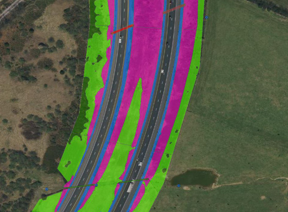
Using mobile LiDAR and our automatic feature extraction tools, we determined Virginia Department of Transportation (VDOT) Staunton District’s Interstate mowing acreage for all of their mowing scenarios. From paritial to full width and tractor to slope to hand mowing, we calculated the acreages from the post-processed and extracted LiDAR point cloud. We also produced shape files and corresponding GIS attributes identifying each mowing area for VDOT’s database.
VDOT District 8 Mowing Acreage Scan