“Now where did I put that (insert item here)?” This is a question I ask myself more than I should. Usually I’m looking for some sort of tool around my house that doesn’t get used very often, but, when I need it I need it now. The wrench to remove the element in my water heater is a good example. When an element goes out it’s usually at the worst possible time.
So the quicker I can find the wrench the quicker I can get the heater fixed. I have gotten better about keeping tools, etc. organized and one thing that has helped me with this is to actually bring home skills that I’ve learned at from work. While keeping track of tools around the house and maintaining incredible volumes of infrastructure are vastly different, there is a commonality in that the core of managing both of these is to know what you have and where it is located.
A drainage pipe can be similar to that missing household wrench in that it is an asset that you may lose track of. The original maintenance crew moves on, retires, etc. and they forgot to tell the new crew about it, the maintenance crew doesn’t have access to the original plans, or the area gets overgrown with brush, etc. Then all of a sudden it rains one day and water is backed into the road. Just like that when you need it you can’t find it.
One of the areas PILLAR helps our infrastructure clients is keeping and maintaining an infrastructure inventory. The roadway infrastructure we deal with was mostly built in the mid1900s with some dating back ever further. Most of these roads had design drawings or plans but not always follow up drawings or asbuilts to show field changes made to plans.
We have incorporated a number of methods and technologies to help our clients collect their inventory, and continuously and easily update what is added and removed. We have used everything from;
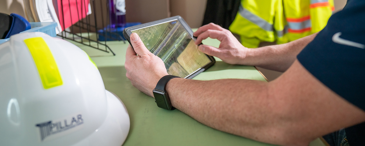
- “Boots on the ground” location where we visually identify an asset location using metal detectors, brush axes, shovels, and an iPad loaded with a specialized application InfraTrak®. This allows us to add inventory, edit and remove inventory as well as log inventory conditions and generate work orders from the field. InfraTrak® works disconnected from the internet with information synced to the cloud where the collected field data is shared with office personnel.
- Mobile LiDAR which generates a digital 3D model of the roadway with corresponding spherical photos taken at specified intervals.
- Digitizing 5060 year old roadway plans.
- Survey and GIS grade asset inventory mapping utilizing traditional GPS and survey equipment.
- Development of a specialized department to explore the use of our cutting edge drone for the generation of digital 3D models, high resolution digital orthophotography, videos, and thermal imaging.
These methods have allowed us to inventory municipal utilities as well as hundreds of miles of roadway for our clients to help them know what they have and where it is located.
Pillar, Inc.’s staff has been involved with highway maintenance and incident response on many different projects with 40+ years of combined experience. We can generate, collect, and maintain digital asset inventories for your existing infrastructure. Please do not hesitate to contact us!